
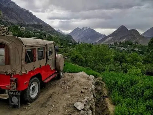
- Karimabad at a Glance
- About Karimabad — quick facts
- Why visit Karimabad — what it's famous for
- When to visit & Karimabad weather
- How to get to Karimabad — practical steps
- Distances & travel times (handy list)
- How many nights do you need in Karimabad?
- Top things to do in Karimabad (with short how-tos)
- Sample itineraries (copy & paste)
- Practical tips, warnings & a short checklist
- FAQs (18 Common Questions)
Quick summary: Karimabad is the historic heart of Hunza Valley — a compact, walkable town with iconic forts, colorful bazaars, turquoise lakes nearby and dramatic Karakoram views. This guide gives you exact travel steps, distances, seasonal advice, local tips, and an itinerary you can use today. Karimabad is the main town of Hunza District in Gilgit-Baltistan, and the base almost every traveller uses for the upper valley. It is a short walk from Baltit and Altit forts, an hour from Attabad Lake, and two hours north of Gilgit on the Karakoram Highway.
We run vehicles and guides through Hunza, so this guide is built around the numbers travellers actually ask us for: distances that match the road rather than the map, realistic drive times, opening hours, and what things cost. Where a figure is disputed between sources, we say so and explain why
Karimabad at a Glance
| Field | Details |
| Where | Hunza District, Gilgit-Baltistan, Pakistan |
| Also known as | Baltit (the town’s former name) |
| Elevation | ~2,600 m at the settlement reference point; the bazaar terrace sits lower, around 2,400–2,450 m |
| Peaks visible | Rakaposhi 7,788 m · Ultar Sar 7,388 m · Ladyfinger (Bublimating) |
| Nearest airport | Gilgit (GIL) — 100 km, about 2h 15m by road |
| Main sights | Baltit Fort · Altit Fort · Karimabad Bazaar · Duikar / Eagle’s Nest viewpoint |
| Usual stay | 3 nights |
| Practical season | April to October |
Why sources disagree about the elevation: Google and Wikipedia both give 2,603 m for Karimabad; most travel guides give 2,400–2,450 m. Both are defensible, because Karimabad is not a single point — it climbs a terrace. The bazaar and most hotels sit near the lower figure; Baltit Fort and the lanes above it sit near the higher one. Expect a difference of roughly 150–200 m between where you sleep and where you photograph.
About Karimabad — quick facts
What it is: Karimabad (formerly Baltit) is the principal town and administrative center of the Hunza District in Gilgit-Baltistan, Pakistan. It sits high in the Karakoram and acts as the gateway to many classic north-Pakistan routes.
Why this matters for travelers: Compact village, highest concentration of accommodations, and immediate access to Baltit & Altit forts — so most visitors base here for 2–4 nights.
Why visit Karimabad — what it’s famous for
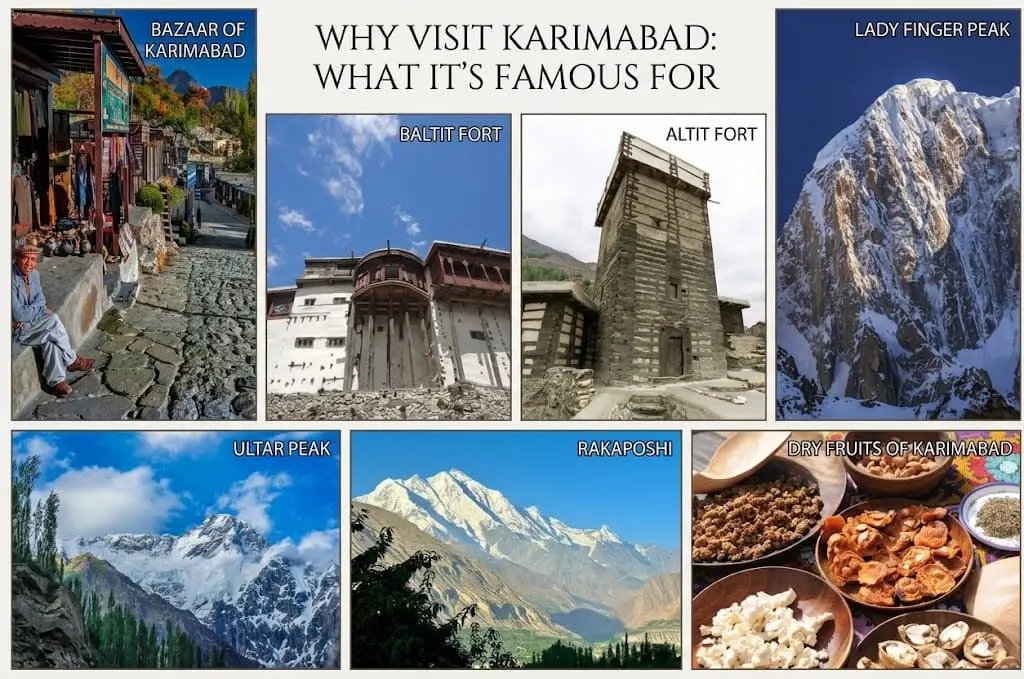
- Baltit & Altit forts: The forts that define Karimabad’s skyline. Baltit Fort is restored and on UNESCO’s Tentative List (2004) — a major cultural draw.
- Dramatic mountain views: Ultar, Ladyfinger and Rakaposhi are visible from viewpoints near town.
- Markets & dry fruits: Local bazaars sell gemstones, traditional handicrafts, and famed Hunza apricots/dry fruits.
Local insight: Spend your first afternoon at the Baltit/Altit circuit to orient yourself — both forts are within a short walk or a 5–10 minute drive from the bazaar.
When to visit & Karimabad weather
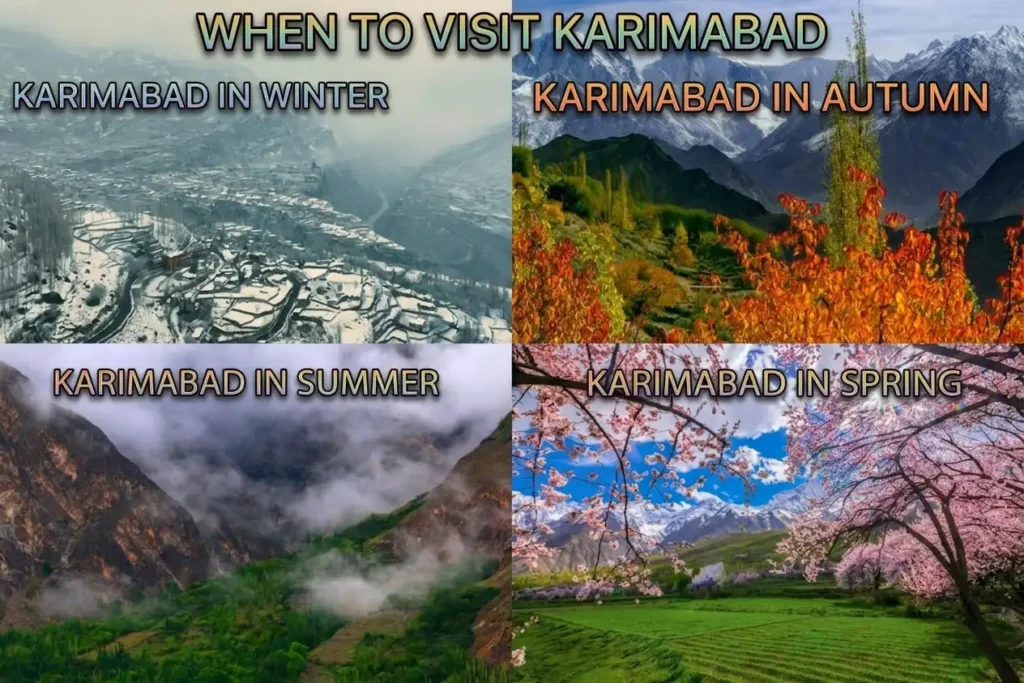
Quick answer: April–October is the practical tourist window (cherry blossom in April, lush summer May–Sep, and spectacular autumn colors in October). Winters are cold and many routes / homestays close.
Karimabad weather — what to expect:
- Spring (Mar–Apr): Orchard bloom; chilly nights.
- Summer (May–Sep): Warm days (but mild by lowland standards), best trekking weather; busy season.
- Autumn (Oct): Cooler, fewer crowds, golden slopes — often the best combination of weather + quiet.
- Winter: Heavy snow, many roads and attractions limited.
⚠️ Warning: Altitude and UV — nights are cold, sun is strong. Use layered clothing and sunscreen.
How to get to Karimabad — practical steps
- By air + road (fastest): Fly to Gilgit Airport (GIL) then transfer ~1.5–2 hours by car to Karimabad. Flights are seasonal and weather-dependent.
- By road (scenic):
- From Islamabad: two main routes — the Karakoram Highway (open year-round mostly) or the seasonal Naran/Babusar route (May–Oct). Road trip is long (12–20 hours depending on route and stops).
- From Skardu or Hunza neighboring towns: see distances section.
Tip: Book a driver who knows the Karakoram Highway (KKH) — landslides happen; local drivers read conditions and time stops well.
Distances & travel times (handy list)
| From Karimabad to | Road distance | Normal drive | Allow up to | Notes |
| Altit Fort | 4 km | 10 min | 30 min on foot | Walkable from the bazaar |
| Duikar / Eagle’s Nest | 5–6 km | 20 min | 45 min | Steep, narrow; see note below |
| Aliabad | 3 km | 8 min | 20 min | Nearest fuel and ATMs |
| Attabad Lake | 34 km | 1h 00m | 1h 30m | Via KKH and the tunnels |
| Passu Cones | 55 km | 1h 30m | 2h 00m | Normal conditions |
| Gilgit | 100 km | 2h 15m | 3h 00m | Nearest airport |
| Skardu | 286 km | 5h 30m | 8h 00m | Long day; see route guide |
| Khunjerab Pass | see route guide | — | — | Sources disagree; we explain why |
On Duikar: You will see figures from 5 km to 11 km for the same trip. The short figure follows the metalled road to the Eagle’s Nest hotel parking; the longer ones follow the older rough track or start counting from lower Karimabad. In a normal car on the metalled road, allow 20 minutes each way, and leave 45–60 minutes before sunset.
On Attabad: Google’s own map says 34 km and just over an hour. Several travel sites say 14 km — that is the distance from Karimabad to the 2010 landslide site, not to where you board a boat today.
How many nights do you need in Karimabad?
Two nights covers the town itself: both forts, the bazaar, and one sunrise or sunset at Duikar. It is enough to say you have seen Karimabad, and it is the shortest stay we would recommend to anyone who has come this far.
Three nights is the right answer for most people. It adds a full day for Attabad Lake and upper Hunza without turning that day into a rush, and it gives you one weather day in reserve — which matters more here than most people expect.
Four or more nights makes sense if you want Passu and the Hussaini bridge properly, a Khunjerab Pass day, or a hike above the town. Karimabad is a comfortable base for all of it, so extending here is usually better than moving hotels.
One night is a mistake unless you are passing through. You will spend most of it arriving and leaving.
Top things to do in Karimabad (with short how-tos)
Baltit Fort & museum — how to do it
- Buy entry ticket at the gate.
- Follow the guided loop (museum rooms are compact).
- Walk to the viewpoint rim for Rakaposhi shots.
Altit Fort + traditional village walk
Combine with Baltit in the same afternoon; Altit is older, grittier and sits lower in the valley.
Duiker / Eagle’s Nest viewpoint at sunset
Short hike or drive; go 45–60 minutes before sunset.
Bazaar, dry fruits & handicrafts
Shop for apricots, walnuts, pomegranates, gemstones and pashmina scarves.
Short treks & day hikes
Ultar Meadows, Bublimo Ting (Lady Finger) viewpoints — hire a local guide for off-trail safety.
Packing tip: Bring a sun hat, warm layer for evenings, sturdy shoes for cobbled paths, and a light rain shell.
Sample itineraries (copy & paste)
- 1-Day (short & sweet): Baltit Fort (AM) → Altit Fort → Karimabad bazaar lunch → Duiker sunset viewpoint.
- 3-Day (balanced): Day 1: Arrive & forts + bazaar. Day 2: Attabad Lake + Passu/Borith viewpoint. Day 3: Half-day hike (Ultar Meadows) + depart.
- 7-Day (deep dive): Add Naltar lakes, Hunza→Khunjerab Pass day trip, Gulmit/Passu exploration, and a village homestay.
Practical tips, warnings & a short checklist
⚠️ Warnings
- Altitude: Acclimatize (no heavy exertion first day).
- Road closures: Babusar & some Deosai routes are seasonal.
Tips
- Mobile & internet: patchy; download offline maps and keep cash.
- Hiring transport: negotiate daily rates with driver + fuel.
Packing checklist (essentials): ID/passport, warm layers, sunscreen, water bottle, headlamp, basic meds, snacks, power bank.
FAQs (18 Common Questions)
1. What district is Karimabad in?
Hunza District, Gilgit-Baltistan.
2. What is Karimabad famous for?
Baltit & Altit forts, bazaars and sweeping Karakoram views.
3. How do I get to Karimabad?
Fly to Gilgit + transfer by car, or road from Islamabad via KKH or Naran routes.
4. Best time to visit Karimabad?
April–October (peak: May–Sep; autumn is quieter and scenic).
5. Is Attabad Lake close?
Yes — roughly 20–35 km; ~30–60 minutes’ drive.
6. How far is Karimabad to Khunjerab Pass?
Roughly 180 km by road; expect a long day with stops.
7. Can I drive to Khunjerab in a sedan?
Mostly yes in summer on KKH, but local advice recommended.
8. Any festivals in Karimabad?
Seasonal local cultural events; dates change year to year.
9. Is Karimabad safe for solo travelers?
Generally safe, but use standard mountain caution and guides for remote treks.
10. Are there internet/mobile services?
Patchy; better in town, poor on remote stretches.
11. Do I need special permits?
For normal tourist routes no; cross-border (China) travel requires documentation.
12. How long to see Karimabad properly?
2–4 days to cover forts, Attabad Lake, and a short hike.
13. Where to buy local handicrafts?
Karimabad bazaar and small shops near the forts.
14. Hospitality & homestays?
Available; book ahead during peak season.
15. Is food safe?
Yes at reputable cafés; bottled water recommended.
16. Best viewpoint for sunrise/sunset?
Duiker / Eagle’s Nest.
17. Can I combine Karimabad with Skardu?
Yes — possible via a long road journey; plan 1–2 travel days.
18. Where to get local guides?
Hotel reception, local travel desks, or trusted operators.