
Gilgit Valley Travel Guide: Hunza, Khunjerab & KKH Route
Gilgit city to Khunjerab Pass — Baltit Fort, Attabad Lake, Passu Cones and the full Karakoram Highway run. Planned by a local team that travels this route every season, with flexible itineraries and straight answers on WhatsApp.
Written by Shahid Hashmi (Tour Operator & Manager), Northern Discover · Last updated 03 September 2026
Gilgit Valley at a Glance
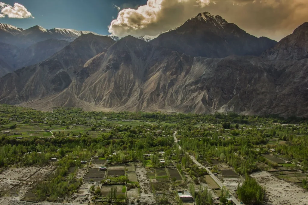
Gilgit Valley is the gateway to Pakistan’s high mountains — the point where the Karakoram Highway leaves the city of Gilgit and climbs through Hunza and Nagar toward the Chinese border at Khunjerab Pass. When people say “Gilgit Valley” in a travel context, they usually mean this entire corridor: Gilgit city, the Hunza-Nagar valleys with Karimabad, Aliabad, Gulmit and Passu, and the high-altitude stretch up to Khunjerab. We use the term the same way here, because that is how almost every real itinerary through this region is actually built, and we think a guide should match how people plan trips, not just how a map divides districts.
This is not a soft, green hill-station kind of valley. It’s rock, glacier, and river — three of the world’s great mountain ranges (the Karakoram, the Himalayas, and the Hindu Kush) converge close to here, and you feel that scale the moment you’re on the road. Rakaposhi rises directly beside the highway. Passu Cones cut into the sky like something drawn with a ruler. Attabad Lake sits an improbable turquoise between grey cliffs. None of it needs exaggeration — it’s simply a landscape built at a different scale than most people are used to.
At Northern Discover, we run guided and custom trips through this exact route every season, and this page is built from what we actually tell travelers before they go: what the road is like, when to come, what things cost, and where the surprises tend to happen. If you’re deciding whether Gilgit Valley belongs on your Pakistan itinerary, or you’re already convinced and need to plan the logistics, this page should get you most of the way there.
Quick Facts
| Region | Gilgit-Baltistan, Pakistan |
| Main gateway city | Gilgit (also reachable via Islamabad by road or air) |
| Key stops along the route | Gilgit city, Nagar Valley, Aliabad, Karimabad, Altit, Gulmit, Passu, Sost, Khunjerab Pass |
| Elevation range | Gilgit city ~1,500 m; Karimabad ~2,500 m; Khunjerab Pass ~4,693 m |
| Distance from Islamabad | Roughly 500–600 km by road via the Karakoram Highway, typically a 14–20 hour drive depending on stops, weather, and road conditions |
| Best travel season | Late April to mid-October for open roads and full access; each month within that window has a different character (see Best Time to Visit) |
| Language | Shina is widely spoken in Gilgit city and surrounding areas; Wakhi and Burushaski are common further up in Hunza and Gojal; Urdu and English are understood in most tourist-facing businesses |
| Currency | Pakistani Rupee (PKR) |
| Typical trip length | 5–10 days for a proper loop covering Gilgit, Hunza, and Khunjerab; shorter trips are possible but involve trade-offs |
Northern Discover builds most of its Gilgit tour packages around this exact corridor, and our Gilgit itinerary page breaks the day-by-day options down further.
Overview: What Gilgit Valley Actually Is
Gilgit Valley is the meeting point of the Karakoram Highway’s most dramatic stretch — a single road connecting Gilgit city to Hunza, Nagar, and eventually China, running alongside the Hunza and Gilgit rivers for most of its length. If you’re trying to picture it before you go: imagine a narrow, fast-flowing river valley squeezed between rock walls and glaciated peaks, with small terraced villages appearing every so often where the valley widens enough for apricot orchards and irrigation channels.
Gilgit city itself is the administrative and transport hub — where flights and long-distance buses arrive, where you’ll find the widest range of hotels, banks, and mechanics, and where most multi-day trips start. It’s a working town rather than a tourist destination in its own right, and that’s not a criticism — it’s useful to know so you don’t expect Karimabad-style scenery right in the city center. The scenery builds as you drive north.
Hunza, reached in two to three hours from Gilgit, is where most travelers’ mental image of “Gilgit Valley” actually lives: Karimabad’s terraced rooftops looking across at Rakaposhi and Ultar, Baltit Fort standing above the town, Altit Fort a short drive below it, and Attabad Lake’s startling blue a little further along the highway. Nagar Valley sits across the river from Hunza and offers a quieter, less-visited version of similar scenery — worth considering if you want the views without the crowds.
Further north, past Gulmit, the valley changes character again. This is Gojal — Wakhi-speaking, glacier country, home to Passu Cones, Borith Lake, and the last towns (Passu, Sost) before the road climbs to Khunjerab Pass and the Chinese border. The vegetation thins, the peaks get closer, and the whole feel of the trip shifts from “valley” to “high mountain.”
Understanding this progression matters for planning: a trip that only reaches Karimabad will feel very different from one that continues to Passu and Khunjerab. Neither is wrong — they’re just different trips, and knowing which one you want changes your itinerary, your budget, and how many days you need.
Why Visit Gilgit Valley
People visit Gilgit Valley for the combination of scale and access — you can stand beside a 7,000-metre peak, walk through a 700-year-old fort, and eat dried apricots grown on the same hillside, all within a single day, without technical climbing or serious expedition logistics. That combination is genuinely uncommon.
The honest reasons travelers keep coming back, based on what we hear most often:
- The mountains are close, not distant. In a lot of mountain destinations, the big peaks are a backdrop you view from a distance. Here, Rakaposhi and Ultar Sar are visible from the main road and from guesthouse rooftops. You don’t need a trek to feel their presence.
- The history is walkable, not roped off. Baltit Fort and Altit Fort are still standing structures you can walk through, not fenced ruins viewed from a platform. They tell you something real about how Hunza’s rulers lived and governed before Pakistan’s independence.
- Attabad Lake is a reminder of how young this landscape still is. The lake didn’t exist before a 2010 landslide dammed the Hunza River — it’s a genuinely new feature of the valley, and locals who lived through the disruption it caused (the highway was submerged for years before the tunnels were built) can often tell you about it firsthand if you ask respectfully.
- The food and hospitality reflect a distinct culture, not a generic “northern Pakistan” package. Burusho, Wakhi, and Shina communities each have their own language, customs, and culinary habits, and that diversity is part of what makes the drive from Gilgit to Khunjerab feel like passing through several different regions rather than one long valley.
- It rewards slower travel. A lot of Pakistan’s northern tourism is built around fast loops — Naran, Kaghan, a quick Hunza stopover. Gilgit Valley has enough depth (forts, lakes, side valleys, hikes) that spending three or four unhurried days here beats rushing through in one.
None of this means the trip is effortless. The roads are long, altitude and weather can disrupt plans, and it’s not a place to visit without some planning. That honesty is exactly why a lot of travelers choose to go with a custom tour rather than work out logistics from scratch — not because the region is unsafe, but because getting the timing, permits, and transport right saves real time and stress.
Top Attractions in Gilgit Valley
Baltit Fort
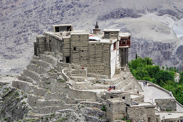
Baltit Fort sits above Karimabad and was the seat of Hunza’s rulers (the Mirs) for centuries before being restored and opened as a museum in the 1990s. Inside, you’ll see original wooden structures, a small collection of period artifacts, and — from the fort’s terrace — one of the best framed views of Rakaposhi and the Hunza valley floor available anywhere in the region. Most visits take 45 minutes to an hour, and it pairs naturally with a walk through old Karimabad.Our Hunza Valley guide covers Baltit, Altit and the rest of Karimabad in more depth in more depth.
Altit Fort
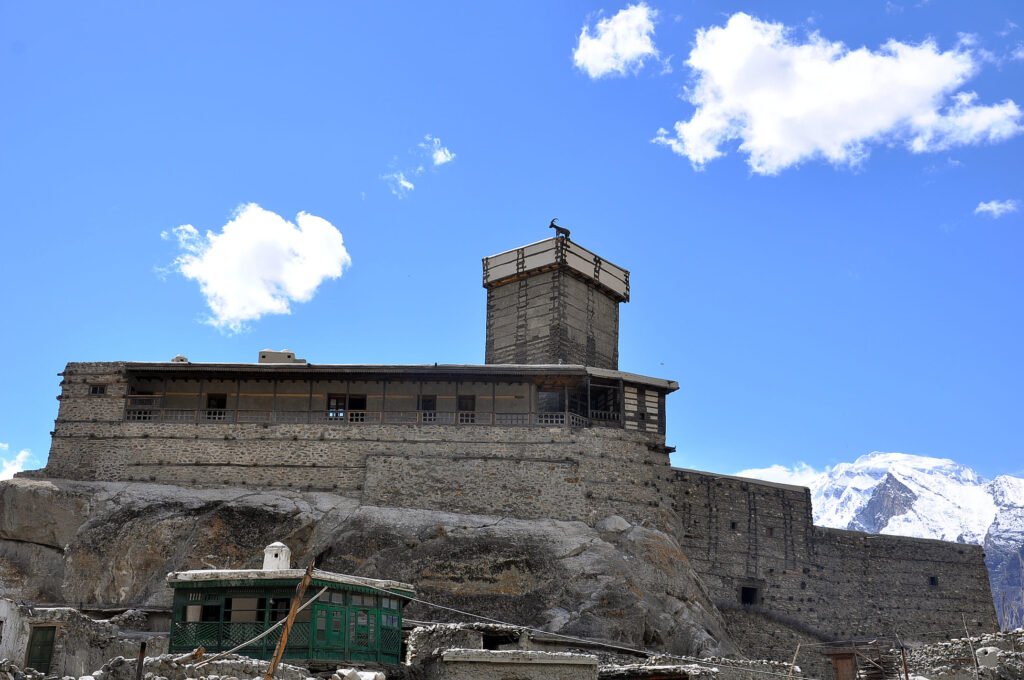
Older than Baltit and built closer to the river, Altit Fort has a rougher, less polished feel that some travelers actually prefer. The surrounding Altit village retains a more traditional layout, and the fort’s position above a sheer drop to the Hunza River gives it a different atmosphere from Baltit’s more open hilltop setting. It’s a short drive from Karimabad, and combining both forts in one day is easy and common.
Attabad Lake

A stretch of turquoise water squeezed between bare rock cliffs, Attabad Lake formed after a landslide blocked the Hunza River in January 2010, submerging part of the original highway for years until new tunnels bypassed the flooded section. Today it’s a boating and photography stop — jet-ski and boat rides are available seasonally, and a short walk along the shoreline gives good vantage points without needing to pay for a ride. Water color shifts noticeably by season and light; it’s often most vivid in clear summer afternoon light.
Passu Cones
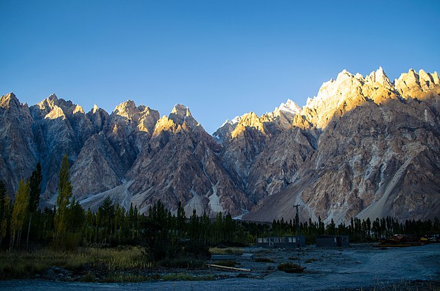
Sharp, triangular peaks rising above the village of Passu, visible directly from the Karakoram Highway without any hike required. They’re one of the most photographed formations in the region, and the classic shot — cones reflected in the Hunza River or framed against the suspension bridge nearby — is achievable for anyone with a car and a few spare minutes at the right time of day.
Khunjerab Pass
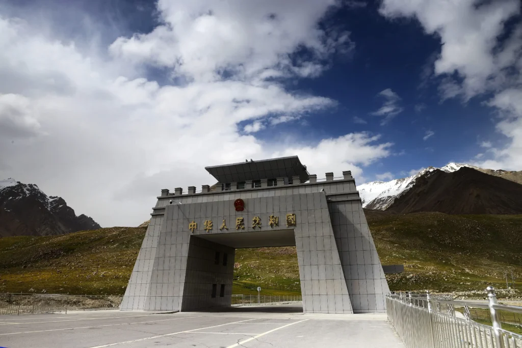
At roughly 4,693 metres, Khunjerab is the highest paved international border crossing in the world, marking the frontier between Gilgit-Baltistan and China’s Xinjiang region. It sits inside Khunjerab National Park, home to Marco Polo sheep, ibex, and — rarely seen — snow leopards. The pass is typically accessible from around May through October; heavy snow closes it for extended periods in winter, and exact opening and closing dates shift year to year depending on weather, so it’s worth confirming current status before building a trip around it. It’s a long drive from Gilgit (roughly 4–5 hours one-way from Gilgit city, longer from Karimabad), and most travelers treat it as a full-day round trip from Sost or Passu rather than a quick stop.
Rakaposhi and Ultar Sar
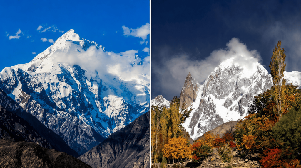
Rakaposhi (7,788 m) and Ultar Sar (7,388 m) frame Karimabad from opposite sides of the valley and are the two peaks most associated with Hunza’s skyline. Rakaposhi View Point, a short drive off the main highway, offers one of the closest roadside views of a 7,000-metre peak anywhere in Pakistan — no trek required, though a short walk from the parking area improves the angle.
Borith Lake
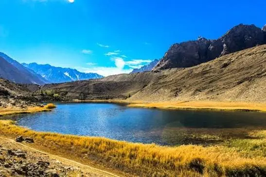
A quieter, higher-altitude lake near Passu, reached by a rough side road or a moderate walk. Borith sees far fewer visitors than Attabad and is popular with birdwatchers and travelers looking for a still, undeveloped setting rather than another photo-stop crowd.
Gulmit and Nagar Valley
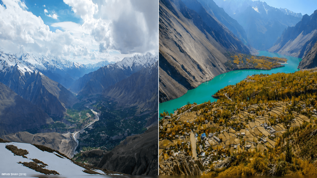
Gulmit is a good base for exploring Gojal without the greater crowds of Karimabad, and it has its own small heritage museum. Nagar Valley, across the river from Hunza, mirrors much of Hunza’s scenery — apricot orchards, glacier views, old settlements — with noticeably fewer tourists, making it worth a detour for travelers who’ve already done the standard Hunza stops.
Things to Do in Gilgit Valley
Beyond sightseeing stops, Gilgit Valley supports a genuine range of active travel, and most of it doesn’t require technical experience.
Hiking ranges from short valley walks (Altit to Baltit along old irrigation channels, or short trails around Karimabad) to more serious treks like Ultar Meadows or the approach toward Rakaposhi Base Camp, which involves a proper full-day or overnight effort. Passu also offers access to glacier-viewing walks that are moderate rather than technical.
Camping is common around Borith Lake, in parts of Gojal, and on some of the higher meadows accessed from Hunza and Nagar. Basic camping gear can usually be arranged locally or through a tour operator; bringing your own is only necessary for more remote sites.
Photography is arguably the single biggest draw for independent travelers — the combination of forts, glaciers, terraced fields, and clear mountain light makes this one of the most photographed regions in Pakistan. See our dedicated notes below and our Gilgit photography guide for timing and locations.
Road trips along the Karakoram Highway are an experience in themselves, not just transport between stops — the road passes glaciers, river gorges, and small villages that reward slow driving with regular stops rather than a rush to the next destination.
Cultural visits to Baltit and Altit Forts, local museums in Gulmit and Karimabad, and simply spending unhurried time in village markets give a much better sense of Burusho, Wakhi, and Shina life than a checklist of sights alone.
Boating and water activities at Attabad Lake operate seasonally, weather permitting, and are best treated as a nice-to-have rather than the centerpiece of a trip.
If you want help sequencing all of this rather than figuring it out stop by stop, our Gilgit tour packages already build these activities into fixed-day plans, and we can adjust the pace for families, photographers, or hikers on a custom tour.
Best Time to Visit Gilgit Valley
The short answer: late April through mid-October is when the Karakoram Highway and the Hunza-Gojal side roads are reliably open, with July to September offering the most stable weather and August/September often considered peak scenery for orchards and clear mountain views. Each month in that window has real trade-offs, though, and “best” depends partly on what you’re after.
April–May: Apricot and cherry blossoms bloom across Hunza’s terraced orchards, giving the valley a soft pink-and-white color against bare peaks still carrying winter snow. Weather can still be unpredictable and some higher passes may only just be reopening.
June–August: The most stable weather window, with reliably open roads including Khunjerab Pass, and long daylight hours for driving and sightseeing. This is also the busiest period for domestic tourism, so hotels in Karimabad fill up and prices rise — booking ahead matters more here than at other times.
September–early October: Widely considered one of the best windows by frequent visitors — clear skies, comfortable daytime temperatures, and the start of autumn color in the orchards, with noticeably fewer crowds than peak summer.
October–November: Autumn foliage across Hunza and Gojal turns gold and orange, a period some photographers specifically time their trips around, though nights get cold and higher routes like Khunjerab can close earlier if snow arrives ahead of schedule.
Winter (December–March): Gilgit city stays accessible, but Khunjerab Pass typically closes and some higher side roads become difficult or impossible without proper winter vehicles. Snow-covered Hunza has its own quiet appeal for travelers specifically seeking that, but it’s a different, more limited trip than a summer or autumn itinerary and needs realistic expectations.
For a fuller month-by-month breakdown, see our Best Time to Visit Gilgit page. We’re also happy to match your travel dates against current conditions on a WhatsApp consultation before you commit to flights.
Weather in Gilgit Valley
Weather here varies more by elevation than by season alone — Gilgit city, Karimabad, and Khunjerab Pass can have meaningfully different conditions on the same day. Gilgit city sits at a lower, drier elevation and gets noticeably hot in peak summer (often into the low-to-mid 30s°C in July), while Karimabad, roughly a thousand metres higher, stays more temperate. Up near Khunjerab, temperatures drop sharply even in summer, and layers are necessary regardless of what the valley floor feels like.
Rainfall is generally low across the whole corridor — this is a dry mountain climate, not a monsoon-affected one — but sudden weather changes at higher elevations, including snow at Khunjerab outside the main travel season, are common enough that flexible planning matters. Packing layers, a good jacket, and sun protection (the UV exposure at altitude is stronger than it feels) covers most scenarios.
How to Reach Gilgit Valley
There are two realistic ways in: by air to Gilgit, or by road along the Karakoram Highway from Islamabad.
By air: PIA operates flights between Islamabad and Gilgit Airport, weather permitting — this is genuinely weather-dependent, since the route crosses high terrain, and flights are cancelled more often in winter and during poor visibility. It’s the fastest option (around an hour in the air) but shouldn’t be the only plan if your schedule is tight; build in a buffer day or a road-travel backup.
By road: The Karakoram Highway from Islamabad to Gilgit is roughly 500–600 km and typically takes 14–20 hours depending on stops, road conditions, and whether you break the journey overnight (which we generally recommend rather than attempting it in one push). Most travelers split this into two days, often overnighting around Chilas or Besham. From Gilgit, the drive further north to Karimabad takes about 2–3 hours, and continuing to Passu or Sost adds another 2–3 hours beyond that.
| Leg | Distance | Typical driving time | Elevation at destination |
| Islamabad → Gilgit (KKH) | 500–600 km | 14–20 hours (split over two days) | ~1,500 m |
| Islamabad → Gilgit (Air) | ~297 km | ~1 hour flight (weather permitting) | ~1,500 m |
| Gilgit → Karimabad (Hunza) | ~100 km | 2–3 hours | ~2,500 m |
| Karimabad → Passu / Sost | ~50 km | 1.5–2 hours | ~2,800 m |
| Gilgit → Khunjerab Pass | ~270 km | 4–5 hours (one way) | 4,693 m |
Private car hire, whether self-arranged or through a tour operator, is the most flexible way to cover this route since public transport options thin out significantly north of Gilgit. Our Gilgit car rental service and Gilgit tour packages both handle this end-to-end, including experienced KKH drivers who know current road and weather conditions — a genuine advantage on a road where landslides and temporary closures aren’t unusual.
Suggested Itineraries
These are starting frameworks, not rigid templates — every trip we plan gets adjusted for the traveler’s pace, interests, and season.
| Trip length | Covers | Reaches Khunjerab? | Best for |
| 3–4 days | Gilgit, Karimabad, Baltit Fort, Altit Fort, Attabad Lake | No | Limited time; classic Hunza sights |
| 5–7 days | Above plus Gulmit, Passu, Borith Lake | No | Recommended balance without rushing |
| 8–10 days | Above plus Sost, full day to Khunjerab Pass | Yes | Complete corridor run to China border |
3–4 Days (Gilgit & Hunza focus): Arrive Gilgit, drive to Karimabad on day one or two, spend a full day covering Baltit Fort, Altit Fort, and Attabad Lake, then return. Good for travelers with limited time who mainly want the classic Hunza sights.
5–7 Days (Gilgit, Hunza & Gojal): Adds Gulmit, Passu, and Borith Lake to the above, with time for a hike and slower photography stops. This is the range we most often recommend as a realistic balance between depth and duration.
8–10 Days (Full corridor including Khunjerab): Extends into Sost and a full-day round trip to Khunjerab Pass, plus a buffer day for weather delays — which matter more the further north you go. This is the version to choose if reaching the China border crossing itself is a priority.
Add-ons worth considering: Nagar Valley as a quieter alternative or addition to standard Hunza stops; an extra night at Gulmit or Passu instead of rushing back to Karimabad each evening.
Our Gilgit itinerary page lays these out day-by-day with driving times, and our team can build a fully custom version around your dates on request.
Travel Costs in Gilgit Valley
Costs vary widely depending on travel style, but as a general shape: budget travelers using shared transport and guesthouses can realistically manage a Gilgit-Hunza trip on a modest daily budget, while private car hire, mid-range hotels, and guided services push costs meaningfully higher — still generally affordable by international standards, but worth planning for rather than guessing.
The biggest cost variables are: whether you hire a private vehicle (recommended for flexibility, especially north of Gilgit) versus using shared vans; hotel category, since Karimabad in particular has everything from basic guesthouses to higher-end boutique properties; and whether you extend the trip to Khunjerab, which adds a full extra day of vehicle time. Entry fees at Baltit Fort, Altit Fort, and Khunjerab National Park are modest but add up across a longer itinerary. Fuel prices and food costs are generally reasonable throughout the region, though prices in more remote stops like Passu and Sost tend to run slightly higher than Gilgit city given transport distances.
For an accurate number specific to your dates and group size, a WhatsApp consultation is faster than trying to piece together per-item estimates yourself.
Accommodation
Gilgit Valley’s accommodation ranges from simple family-run guesthouses to established mid-range hotels, concentrated most heavily in Gilgit city and Karimabad, with fewer but adequate options in Gulmit, Passu, and Sost. Karimabad in particular has grown a strong guesthouse and boutique-hotel scene over the past decade, often with rooftop views toward Rakaposhi that are genuinely part of the experience, not just a marketing line.
Booking ahead matters more in peak season (June–August and around national holidays) when Karimabad in particular fills up quickly. Outside peak months, more flexibility exists to choose on arrival, though we’d still recommend confirming key nights ahead if your itinerary is tight.
For specific property recommendations by budget and location, see our Gilgit hotels page, or let us handle booking as part of a full Gilgit tour package.
Transportation Within Gilgit Valley
Once you’re in the region, a private vehicle is the most practical way to move between Gilgit, Hunza, Gojal, and Khunjerab — the terrain and distances make walking or cycling between towns impractical for most itineraries, and shared van services, while available, run on their own schedules and aren’t ideal if you want to stop for photos or side visits along the way.
Hiring a car with an experienced driver removes a lot of the uncertainty that comes with unfamiliar mountain roads, seasonal closures, and altitude-related vehicle strain. Our Gilgit car rental service covers this specifically, with drivers who know current road conditions on the KKH — genuinely useful given how often small landslides or temporary blockages affect timing, especially after rain or snowmelt.
Featured Tours
Northern Discover runs a range of fixed-departure and custom itineraries through Gilgit Valley, from short Hunza-focused trips to full Gilgit–Khunjerab expeditions. If you’d rather have the driving, permits, hotel bookings, and daily logistics handled for you, our Gilgit tour packages are the fastest way to get a properly sequenced trip without piecing it together yourself. For travelers with specific dates, group sizes, or interests (photography-focused, family-friendly, hiking-heavy), a custom tour built around your priorities is usually a better fit than a fixed package — reach out via WhatsApp and we’ll put together options.
Culture of Gilgit Valley
Gilgit Valley isn’t culturally uniform — it’s a corridor through at least three distinct linguistic and cultural communities, and noticing the shift between them is part of what makes the drive interesting. Shina is the dominant language around Gilgit city and much of the surrounding lower valley. Moving into Hunza and Nagar, Burushaski — a language with no confirmed relation to any other language family, which linguists still debate the origins of — is widely spoken among the Burusho community. Further north into Gojal, around Gulmit, Passu, and Sost, Wakhi becomes the dominant language, spoken by communities with strong historical and cultural ties to the wider Pamir region across the border.
This linguistic diversity comes with real differences in custom, dress, and daily life, though Urdu and English are understood widely enough in tourist-facing settings that visitors rarely face communication barriers. Hunza in particular is known for comparatively high literacy rates and a strong tradition of hospitality toward travelers, something most visitors notice within their first day.
Traditional festivals mark seasonal transitions — Nowruz in spring, and various harvest and seasonal celebrations tied to the apricot and cherry harvests in Hunza, are among the events visitors sometimes get to see depending on timing, though exact dates and public accessibility vary year to year, so it’s worth asking locally or checking with us if a specific festival is a priority for your trip.
Respectful behavior matters here as anywhere: asking before photographing people, dressing modestly (particularly in more conservative villages further from the main tourist towns), and taking time to actually talk with hosts rather than treating a homestay purely as accommodation all go a long way toward a better, more genuine experience.
Food in Gilgit Valley
Local cuisine across the valley draws heavily on what actually grows and survives here — apricots, mulberries, walnuts, wheat, and dairy from yak and cattle, rather than imported staples. Apricots in particular are close to a defining local ingredient: eaten fresh in season, dried for the rest of the year, and pressed for their oil, which shows up in cooking and even in some traditional skincare. Dry fruits generally — apricots, mulberries, walnuts, almonds — are a genuine local specialty and a common thing travelers bring home, sold in markets in Gilgit city and Karimabad.
Common dishes worth trying include various forms of local bread baked in traditional ovens, apricot-based desserts and soups, and dairy-heavy dishes reflecting the region’s herding traditions. Meals in guesthouses and homestays are often simpler and more genuinely local than in city-facing restaurants, and trying at least one home-cooked meal, if the opportunity comes up, is usually worth prioritizing over another restaurant stop.
Shopping in Gilgit Valley
The most genuinely worthwhile shopping here is dry fruit and local produce — apricots, mulberries, walnuts, and almonds, sold both fresh in season and dried year-round, in markets in Gilgit city and along Karimabad’s main bazaar. Handicrafts, particularly wool and pashmina products, embroidered caps, and semi-precious stones (some genuine, some not, so buying from established shops rather than roadside stalls reduces risk) are also common. Prices are generally negotiable outside fixed-price shops, and buying directly from small family stalls, rather than larger tourist-facing outlets, often gets better value and puts money more directly into local hands.
Photography in Gilgit Valley
This is one of the most photogenic corridors in Pakistan, and a few practical notes make a real difference to results. Early morning and late afternoon light gives the best definition on the surrounding peaks, particularly at Rakaposhi View Point and around Passu Cones, where midday light tends to flatten the contrast that makes these formations distinctive. Attabad Lake’s color shifts with light angle and season, and calm, clear mornings generally give the most vivid blue.
Baltit and Altit Forts photograph well both from below (using the terraced village rooftops as foreground) and from their own terraces looking out — worth allocating time for both angles rather than rushing through. Autumn (October) adds strong color to orchard shots throughout Hunza and Gojal, while spring blossom season (April) offers a completely different but equally strong seasonal look.
Ask before photographing people directly, especially in smaller villages — most locals are genuinely friendly about it if asked first, less so if photographed without acknowledgment. Our Gilgit Photography Guide covers specific viewpoints, timing, and gear considerations at greater length.
Travel Tips for Gilgit Valley
- Altitude matters more than the distances suggest. Karimabad and especially Khunjerab sit high enough that some travelers feel mild effects (headaches, breathlessness on exertion). Pace yourself, especially on the first day at higher elevation.
- Cash is still king outside Gilgit city. ATMs thin out quickly north of Gilgit, and card acceptance is limited. Carry enough Pakistani Rupees for your whole trip north of the city.
- Mobile signal is inconsistent north of Hunza. Don’t rely on constant connectivity once you’re past Gulmit; download maps and confirm bookings before heading further north.
- Road conditions change with weather. Landslides, temporary blockages, and seasonal closures (especially at Khunjerab) are a normal part of travel here, not a sign anything has gone wrong — build in flexible days if your itinerary is tight.
- Foreigners may need to register at checkpoints along the route; this is routine and generally quick, but having your passport and any required permits easily accessible saves time.
- Layer your clothing regardless of season — temperature swings between the valley floor and higher points like Khunjerab are significant even in summer.
For anything specific to your itinerary or nationality, our WhatsApp consultation is the fastest way to get a direct answer rather than a general one.
Nearby Destinations
Gilgit Valley connects naturally to several other well-known parts of Gilgit-Baltistan, and many travelers extend their trip rather than treating Gilgit-Hunza as a standalone loop. Naran and Kaghan lie along a separate route further south and are often combined with a Gilgit trip by travelers doing a longer northern Pakistan circuit. Skardu, reachable by a separate road or short flight, offers a different landscape of high-altitude lakes and is commonly paired with Gilgit-Hunza on longer itineraries. Deosai National Park, accessible from the Skardu side, is a further extension for travelers with more time. If you’re weighing whether to combine any of these with a Gilgit Valley trip, our team can map out a combined route that makes sense for your available days rather than trying to force too much into too little time.
Frequently Asked Questions
Is Gilgit Valley safe for tourists?
Gilgit-Baltistan, including the Gilgit-Hunza-Khunjerab corridor, is generally considered one of the more stable and tourist-friendly regions of Pakistan, with a well-established tourism infrastructure. As with any mountain travel, the main practical risks are road conditions, altitude, and weather rather than security concerns. Checking current travel advisories from your own government before departure is still sensible practice for any international trip.
How many days do I need for Gilgit Valley?
A minimum of 4–5 days lets you cover Gilgit city and the core Hunza sights properly. 7–10 days allows a fuller trip including Gojal and Khunjerab Pass without rushing. Shorter trips are possible but involve real trade-offs in what you can see.
Can I visit Gilgit Valley without a guide?
Yes — independent travel is common, particularly for the Gilgit-to-Karimabad section, where infrastructure is straightforward. Further north, and especially if you want to reach Khunjerab, local knowledge of current road and weather conditions becomes more valuable, which is why many independent travelers still hire a car and driver rather than self-drive the full route.
Is Khunjerab Pass open year-round?
No. Khunjerab Pass is generally accessible from around May through October and typically closes for extended periods in winter due to heavy snow. Exact opening and closing dates vary year to year based on weather, so it’s worth confirming current status close to your travel dates rather than assuming a fixed calendar.
What’s the difference between Gilgit city and Hunza?
Gilgit city is the regional hub and transport gateway — administrative, practical, and less scenic day-to-day. Hunza (including Karimabad, Aliabad, and Altit) is roughly two to three hours further north and is where most of the iconic scenery, forts, and photography spots are actually located.
Do I need a permit to visit Gilgit Valley?
Domestic and most international travelers don’t need special permits for the standard Gilgit-Hunza-Khunjerab route, though checkpoint registration along the way is routine. Requirements can vary by nationality, so confirming your specific situation ahead of travel is worthwhile.
Plan Your Gilgit Valley Trip
If you’ve read this far, you likely already have a sense of whether Gilgit Valley fits what you’re looking for. The next steps are usually one of: browsing our ready-built itineraries, requesting a custom tour built around your dates and interests, or simply messaging us on WhatsApp with questions before committing to anything. We plan these trips year-round and are glad to talk through timing, budget, or route options — no pressure, just direct answers from people who know this specific stretch of road well.