
Top 10 Beautiful Places to Visit in Gilgit-Baltistan: Which Destinations Should You See First?
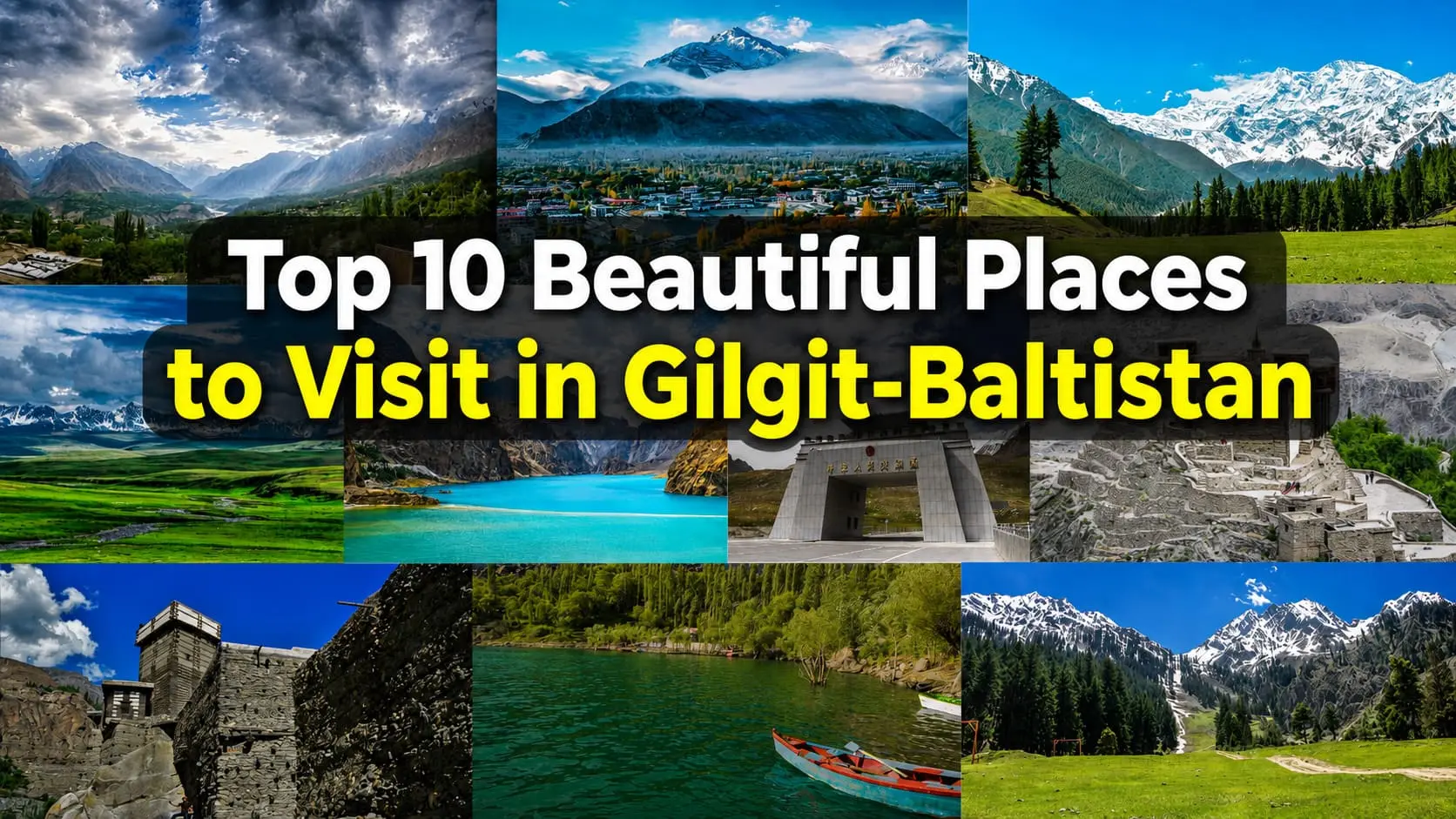
Hunza Valley, Skardu, and Fairy Meadows top this ranking because they combine accessible roads, established lodging, and year-round name recognition among travelers. The list below ranks all ten destinations by iconic status, then gives the practical numbers needed to start planning: district, elevation, best season, and approximate travel time from Islamabad or the nearest hub.
These are the most beautiful places in Gilgit-Baltistan for travelers seeking mountains, lakes, forts, valleys, and unforgettable landscapes.
| Rank | Destination | District | Elevation | Best Season | Travel Time | Highlight |
|---|---|---|---|---|---|---|
| 1 | Hunza Valley (Karimabad) | Hunza | 2,438 m | April–October | 1h15 flight to Gilgit + 2.5h drive, or 16–19h by road | Cherry blossoms, Karakoram views, Baltit Fort |
| 2 | Skardu | Skardu | 2,228 m | April–October | 1h10 flight from Islamabad, or 22–26h by road | Shigar Fort, desert dunes, K2 base camp gateway |
| 3 | Fairy Meadows | Diamer | 3,300 m | June–September | 12–14h to Raikot Bridge, plus jeep and trek | Nanga Parbat North Peak views |
| 4 | Deosai National Park | Skardu/Astore | 4,114 m (avg.) | July–August | 2.5h jeep from Skardu | Himalayan brown bears, Sheosar Lake |
| 5 | Attabad Lake | Hunza (Gojal) | 2,559 m | April–October | 2.5–3h drive from Gilgit | Turquoise landslide lake, boating |
| 6 | Khunjerab Pass | Hunza (Gojal) | 4,693 m | May–September | 2h from Sost, 3h from Karimabad | World’s highest paved border crossing |
| 7 | Baltit Fort | Hunza | 2,500 m (approx.) | Year-round, best April–October | Inside Karimabad town | 700-year-old royal seat, Karakoram panorama |
| 8 | Altit Fort | Hunza | 2,350 m (approx.) | Year-round, best April–October | 10 minutes from Karimabad | Oldest monument in Gilgit-Baltistan |
| 9 | Upper Kachura Lake | Skardu | 2,500 m (approx.) | May–October | 25 minutes from Skardu city | Freshwater lake, resort stays |
| 10 | Naltar Valley | Gilgit | 3,050 m (base) | March–April (skiing), June–October (lakes) | 2h drive from Gilgit, then jeep | Alpine lakes, ski slopes, autumn forests |
These ten destinations span four districts and three distinct geographic zones: the Karakoram core around Hunza and Gojal, the Baltistan plateau around Skardu, and the Himalayan foothills of Diamer. Each destination below includes its district, road access via the Karakoram Highway or Skardu Road, best travel season, estimated costs, and recommendations for families, photographers, trekkers, or first-time visitors.
Why Gilgit-Baltistan Is Pakistan’s Most Scenic Region
Gilgit-Baltistan sits at the convergence of three major mountain systems: the Karakoram, the western Himalaya, and the Hindu Kush. No other region in Pakistan, or arguably in Asia, offers this geological overlap within a single province. Five of the world’s fourteen peaks above 8,000 meters lie partly or wholly within its borders, including K2 in Shigar district, Nanga Parbat in Diamer, and the Gasherbrum group near Concordia.
This is not one undifferentiated mountain zone. Hunza and Nagar sit on opposite banks of the Hunza River in the Karakoram’s central belt. Gilgit district anchors the regional capital and the road network. Ghizer stretches west toward Shandur Pass. Skardu and Shigar form the Baltistan plateau, a drier, more desert-like landscape than Hunza. Diamer, home to Fairy Meadows and the Babusar route, belongs administratively and geographically to the Himalayan side.
Gilgit-Baltistan contains several places recognized for their outstanding natural and cultural importance. Deosai National Park, Baltit Fort, and the wider Hunza cultural landscape all appear on UNESCO’s Tentative World Heritage List, highlighting the region’s international significance. The Karakoram Highway, completed in 1982 and extensively rebuilt after the 2010 Attabad landslide, made these destinations far more accessible to domestic and international travelers.
Travelers typically combine Karimabad’s heritage forts, Skardu’s lakes and deserts, and Fairy Meadows’ close-up views of Nanga Parbat into a single journey through the Karakoram and western Himalayan regions.Together, these destinations represent the leading tourist attractions in Gilgit-Baltistan, attracting visitors from Pakistan and around the world.
K2, Rakaposhi, and Khunjerab Pass are among the most recognizable high-altitude landmarks in Gilgit-Baltistan and consistently rank among the destinations travelers seek when planning a trip to Northern Pakistan.
1. Hunza Valley – The Most Popular Destination in Gilgit-Baltistan
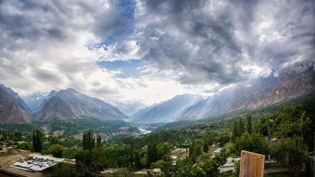
Hunza Valley ranks first because it pairs the region’s most dramatic peak scenery with the best tourist infrastructure in Gilgit-Baltistan. Centered on Karimabad in Hunza district, the valley sits below Rakaposhi (7,788 m), Diran Peak (7,257 m), and Ultar Sar (7,388 m).
Karimabad serves as the base for most visitors, with Baltit Fort and Altit Fort within walking distance. Duikar village, above Karimabad, offers the valley’s widest sunrise viewpoint over Rakaposhi and the Hunza River below. Eagle’s Nest, reached by a short jeep ride from Duikar, is the standard sunset photography stop for the entire valley.
Most visitors spend their time hiking to Ultar Meadows, driving to Duikar and Eagle’s Nest viewpoints, exploring Karimabad’s historic forts, or continuing north toward Passu and Hussaini Suspension Bridge rather than attempting multi-day expeditions. The Ultar Meadows trail starts above Baltit Fort and climbs roughly 4–5 hours to a base camp with direct Ultar Glacier views. Passu, further north in Gojal, adds the Passu Cones and Hussaini Suspension Bridge to a Hunza itinerary.
Hotels cluster in three price bands: Serena Hunza and Eagle’s Nest Hotel at the top end, mid-range guesthouses like Hunza Embassy and Darbar Hunza around Karimabad, and budget homestays in Aliabad and Ganish village. Most rooms book out during the April cherry blossom window and the October foliage season, so reserve at least three weeks ahead for those months.
Photographers usually head to Duikar before sunrise for views of Rakaposhi and Ultar Sar, then return to Eagle’s Nest before sunset when golden light illuminates the Hunza Valley below. April brings apricot and cherry blossoms across Karimabad’s terraced orchards; October turns the same terraces orange and red.
Travel time from Islamabad runs 16–19 hours by road via the Karakoram Highway, or roughly 1 hour 15 minutes by flight to Gilgit followed by a 2.5-hour drive. Best season runs April through October; November through March brings snow at higher elevations and reduced hotel availability. Hunza suits couples, photographers, and families with older children equally well, given its paved roads and short walking distances between sights.
2. Skardu – Gateway to the World’s Highest Mountains
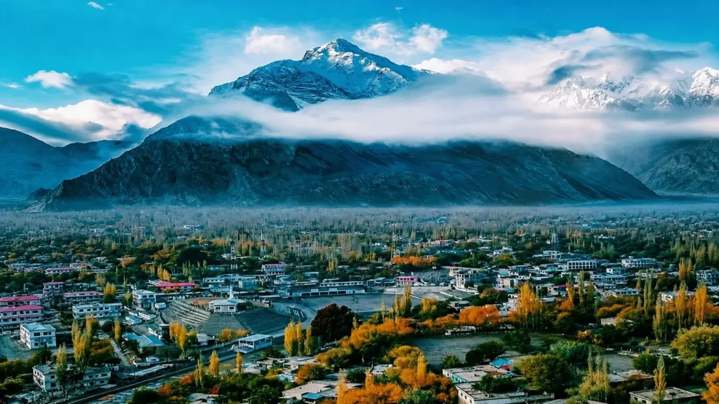
Skardu earns the second spot as the launch point for K2, Gasherbrum, and Broad Peak expeditions, while also offering lake and desert scenery accessible to non-trekkers. Skardu district sits along the Indus River at 2,228 meters, roughly 130 km southeast of Gilgit by road.
Shangrila Resort, built around the Lower Kachura Lake, remains the valley’s most photographed property. Satpara Lake, 8 km from Skardu city, supplies the city’s drinking water and offers boating against a backdrop of bare granite peaks. Skardu’s Cold Desert, a stretch of sand dunes along the Indus near Sadpara Road, is one of the highest-altitude deserts in the world. Kharpocho Fort, overlooking the city from a rocky outcrop, dates to the 16th century and gives a panoramic view over the Indus confluence.
Skardu is also the standard staging point for the Deosai Plains, the Baltoro Glacier trek toward K2 Base Camp, and shorter treks like the Gondogoro La route. Trekking agencies based in Skardu city arrange porters, permits, and gear for multi-day routes into Central Karakoram National Park.
Hotels range from Shangrila Resort and Serena Shigar Fort (a restored 17th-century fort 32 km from Skardu) at the high end, to mid-range options like Hotel One Skardu and a growing number of riverside guesthouses along the Skardu–Shigar road.
The most reliable months are May through October. June through August give the clearest skies for mountain photography and the only window when Deosai’s road is fully open. Travel time from Islamabad is approximately 1 hour 10 minutes by direct flight, though flights are weather-dependent and frequently delayed; the road alternative via the Karakoram Highway and Skardu Road takes 22–26 hours. Skardu suits trekkers, mountaineering groups, and photographers seeking landscapes beyond Hunza’s cherry-blossom imagery.
3. Fairy Meadows – Best View of Nanga Parbat
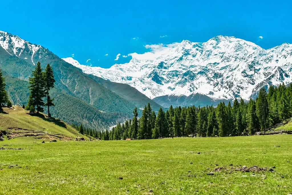
Fairy Meadows ranks third because it delivers the closest accessible view of an 8,000-meter peak anywhere in Pakistan without a multi-day expedition. The meadow sits at 3,300 meters in Diamer district, on the Rakhiot side of Nanga Parbat (8,126 m).
Access starts at Raikot Bridge on the Karakoram Highway, roughly 80 km south of Gilgit. From there, a 15-kilometer jeep track climbs to Tattu village; this stretch is unpaved, narrow, and managed exclusively by local licensed drivers, since outside vehicles are not permitted. From Tattu, a 5-kilometer trek of roughly 3–4 hours leads to Fairy Meadows itself.
The trek is moderate rather than technical, gaining around 600 meters through pine forest. Porters and horses are available in Tattu for travelers who prefer not to carry packs. From Fairy Meadows, the Nanga Parbat Base Camp trek adds another 3-hour round trip with closer views of Raikot Glacier; note that the peak visible from the meadow is the North Peak (7,816 m), not the true 8,126-meter summit.
Accommodation at Fairy Meadows consists mainly of wooden cabins and campsites operated by local lodges such as Raikot Serai and Beyal Camp, with very few permanent hotels available. Most operators provide heated wooden huts or tents at sites like Raikot Serai, with Beyal Camp as a common overnight stop for travelers continuing toward Base Camp. Carry warm layers regardless of season, since nights drop to 5–10°C even in July and August.
Weather shifts quickly at this altitude, and landslides on the jeep track are most common in July and August after sustained rain, so building one buffer day into any Fairy Meadows itinerary is standard practice. The jeep track and trek are open from May through October; snow closes access from late October through April. Fairy Meadows suits trekkers and photographers comfortable with a demanding access route, and is workable for families with children aged ten and up.
4. Deosai National Park – The Land of Giants
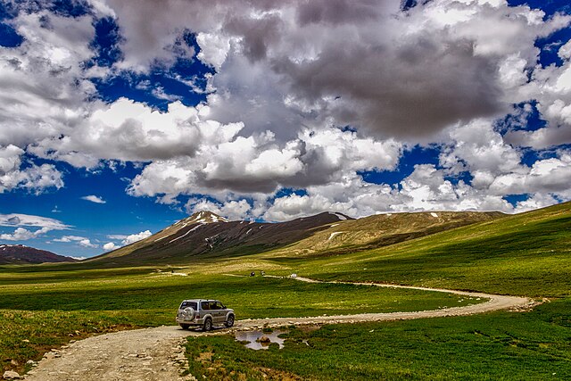
Deosai National Park ranks fourth for hosting the densest concentration of high-altitude wildlife in Gilgit-Baltistan across a plateau most visitors reach in a single day from Skardu. The park spans the border of Skardu and Astore districts at an average elevation of 4,114 meters, making it the world’s second-highest plateau.
Established in 1993 to protect the Himalayan brown bear, Deosai’s bear population has grown from 19 individuals at founding to roughly 72–78 today. Sheosar Lake, the park’s largest at 4,250 meters, anchors most day visits and overnight camps. Bara Pani and Kala Pani rivers offer designated trout-fishing spots, with permits issued on-site for a small fee.
Jeep routes into the park run from three directions: a 30-kilometer drive from Skardu city (the shortest and most common approach), a longer route from Astore via Chilim, and a less-traveled approach via Galtari Tehsil. A 4×4 vehicle is required on all routes; the unpaved tracks become hazardous for standard cars after rain.
Late June through early September is wildflower season, when the plains turn into a carpet of alpine blooms and butterfly activity peaks. July and August give the best wildlife visibility, since bears and marmots are most active during these months. Entry permits are issued at the Bara Pani checkpost by Gilgit-Baltistan’s Wildlife Department; fees vary by nationality and should be confirmed locally before travel, since rates change between seasons.
Deosai has no permanent settlements and almost no mobile signal, so self-sufficiency matters: carry food, water, and a sleeping bag rated for sub-zero nights even in summer. The park is accessible from mid-June through late October and closes completely under snow the rest of the year. Deosai suits wildlife photographers, campers, and travelers who have already adjusted to altitude in Skardu.
5. Attabad Lake – Hunza’s Turquoise Wonder
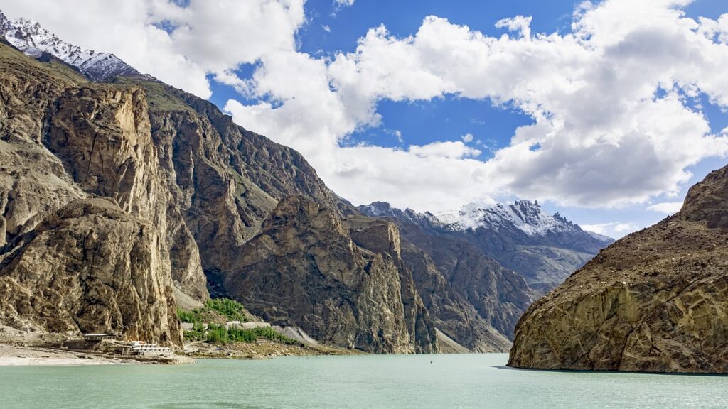
Attabad Lake ranks fifth as the most accessible turquoise-water destination in the region, reachable by paved road without any trek or jeep track. The lake sits in the Gojal sub-district of Hunza at roughly 2,559 meters, about 14 km east of Karimabad.
The lake did not exist before January 2010, when a landslide near Attabad village blocked the Hunza River and submerged roughly 19 kilometers of the Karakoram Highway along with the villages of Shishkat and parts of Gulmit. It stretched to over 20 kilometers in length and more than 100 meters in depth before stabilizing. The Pakistan-China Friendship Tunnels, a 24-kilometer realigned stretch of the KKH with five tunnels, reopened the route in 2015 and now bypass the submerged highway section entirely.
Boating from Shishkat and Gulmit jetties is the most popular activity on Attabad Lake, with speedboats, traditional wooden boats, and seasonal jet ski rentals operating throughout the summer months. In winter, sections of the lake can freeze enough for informal ice-skating, though this depends on temperature and is not guaranteed each year.
Nearby attractions extend a half-day Attabad visit into a full day: Passu Cones and the Hussaini Suspension Bridge lie roughly 20 minutes further north, while Gulmit village offers cafés and handicraft stalls along the old KKH alignment.
Road access from Gilgit takes about 2.5 to 3 hours via the Karakoram Highway, all of it paved since the tunnel realignment. Best season runs April through October, when the lake’s color is most vivid from glacier melt; winter brings dramatic but colder, sometimes ice-bound scenery. Attabad suits families, couples, and day-trippers based in Karimabad who want a low-effort scenic outing.
6. Khunjerab Pass – Pakistan’s Highest Border Crossing
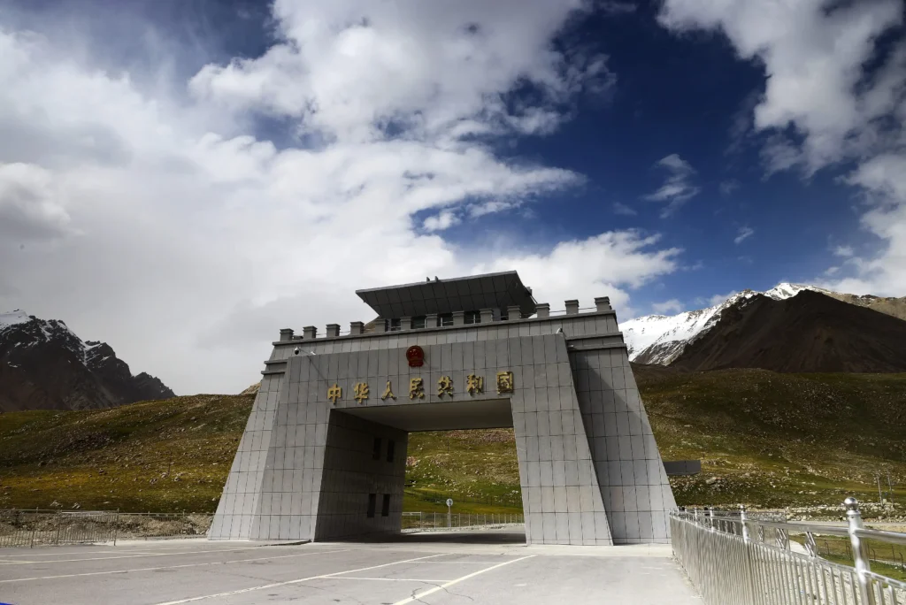
Khunjerab Pass ranks sixth as a milestone destination rather than a multi-activity stop, valued for its altitude record and border-crossing novelty more than for things to do once there. The pass sits at 4,693 meters in Hunza district’s Gojal sub-division, on the Pakistan-China border within Khunjerab National Park.
It is the highest paved international border crossing in the world and the highest point on the entire Karakoram Highway. The crossing connects Sost, Pakistan’s last town before the border, with Tashkurgan in China’s Xinjiang region. The Pakistani side has the world’s highest ATM, though it frequently does not accept foreign cards.
Khunjerab National Park, surrounding the pass, protects Marco Polo sheep, Himalayan ibex, and a small population of snow leopards, though sightings of the latter are rare. Golden eagles and lammergeiers are commonly spotted overhead near the pass itself.
The border operates only on a limited schedule and closes entirely from roughly November through April under snow; there are no fixed annual opening dates, since they depend on weather. Travelers crossing into China need a valid Chinese visa arranged in advance, and Pakistani entry into the national park area requires a park entry fee, payable in rupees at the checkpost.
Travel time is about 2 hours from Sost or roughly 3 hours from Karimabad, all on paved Karakoram Highway. Altitude sickness is a real risk at this elevation; travelers coming directly from Hunza without acclimatization should limit time at the pass and avoid exertion. Best months are May through September, before autumn snowfall narrows the window. Khunjerab suits bucket-list travelers and cyclists more than families with young children, given the altitude.
7. Baltit Fort – Hunza’s Historic Landmark
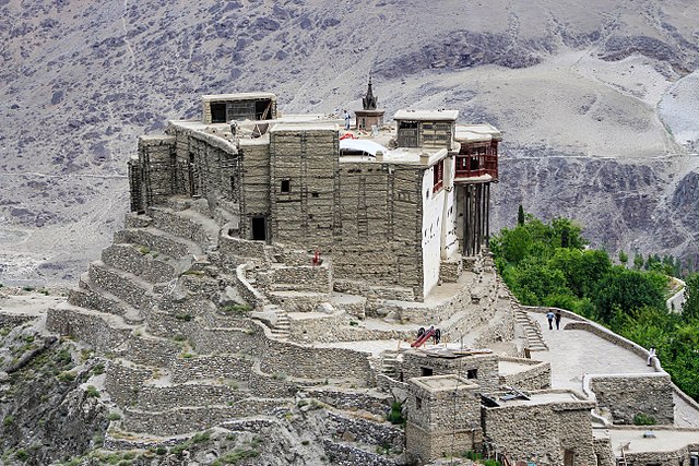
Baltit Fort ranks seventh as the most visited heritage building in Hunza district, standing above Karimabad as the former seat of the Mirs of Hunza. The fort’s foundation dates to the 8th century CE, with major architectural additions carbon-dated to the 13th and 15th centuries.
Its current appearance reflects a 16th-century renovation ordered after Hunza’s ruler, Ayashoo II, married Princess Shah Khatoon of Baltistan; she brought Balti craftsmen whose work gave the fort a style echoing Tibet’s Potala Palace. The Mirs occupied Baltit Fort until 1945, when the royal family relocated to a new palace lower in Karimabad. A restoration led by the Aga Khan Trust for Culture, completed in 1996, converted the fort into a museum and placed it on UNESCO’s World Heritage Tentative List in 2004.
Inside, the fort spans three floors: ground-level storage chambers, a first-floor open hall, and upper floors containing the audience hall, royal bedrooms, and a 19th-century cannon test-fired by Hunza state in 1863, still on display.
The fort is open daily, typically 9 AM to 5 PM, with entry fees around PKR 800 to PKR 1,000 for local Pakistani nationals and PKR 1,000 to PKR 1,200 for foreign nationals; guided tours run 25–35 minutes and are included with most tickets. Cafés cluster in the old bazaar lane leading up to the fort entrance, including several rooftop spots with direct Rakaposhi views.
Baltit Fort requires no separate travel time beyond reaching Karimabad itself, since it sits within walking distance of the town center. It suits history-focused travelers, families, and anyone combining a half-day fort visit with Karimabad’s bazaar and viewpoints.
8. Altit Fort – The Oldest Fort in Hunza
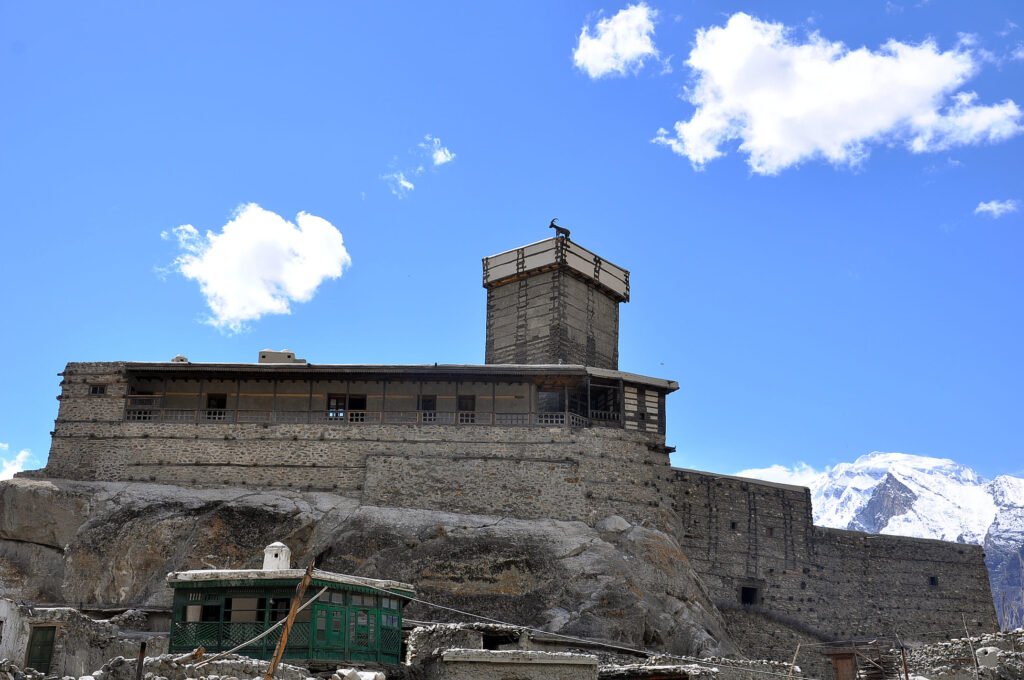
Altit Fort ranks eighth, just behind Baltit, as the older but less elaborately preserved of Hunza’s two royal forts. Located in Altit town roughly 10 minutes from Karimabad, the fort’s Shikari watchtower is approximately 1,100 years old, making it the oldest standing monument in Gilgit-Baltistan.
Altit Fort was the original seat of Hunza’s Mirs before the ruling family relocated to Baltit Fort three centuries later, following a succession dispute between two brothers. The fort fell into disrepair after that move and was restored by the Aga Khan Trust for Culture alongside Norway’s government, reopening to visitors in 2007. It received UNESCO’s Asia-Pacific Award of Distinction for Cultural Heritage Conservation in 2011.
The Royal Garden surrounding the fort, known locally for its orchard terraces, now houses the Altit Khanu Kuts settlement and the Kha Basi Café, a common lunch stop after the fort tour. The fort’s interior is smaller and more austere than Baltit’s, with narrow rooms, low wooden portals, and carved doorways reflecting pre-15th-century Hunza architecture.
Cultural importance here centers on continuity: Altit’s surrounding village still houses descendants of the original Khanu Kuts and Hussain Kuts tribes, and walking tours through the old settlement are commonly paired with the fort ticket. Entry runs roughly PKR 200 for locals and PKR 1,600 for foreign visitors, including a guide.
Altit Fort is open year-round, with the same April–October best season as the rest of Hunza for comfortable walking weather. Travel time from Karimabad is about 10 minutes by road. The destination suits history travelers and photographers more than families seeking activities, given its smaller scale compared to Baltit.
9. Upper Kachura Lake – Skardu’s Quiet Alpine Lake
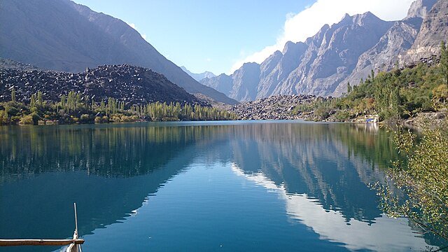
Upper Kachura Lake is one of the most visited scenic lakes near Skardu, attracting visitors for its clear alpine water, mountain setting, and easy access from the city.Located roughly 30 minutes from Skardu city, Upper Kachura sits at an elevation of approximately 2,500 meters in a narrower, less commercialized valley than its lower counterpart.
The lake’s water carries a deep green-blue color from mineral sediment, distinct from the brighter turquoise of Attabad or Lower Kachura. Boating is available through a small number of local operators, with rowboats more common here than the motorized boats found at Shangrila. Trout fishing draws a smaller crowd than Deosai’s rivers but is permitted seasonally with a local fee.
Resorts and guesthouses around Upper Kachura remain limited compared to Skardu city or Shangrila; most visitors treat it as a half-day trip rather than an overnight stay, basing themselves in Skardu instead. A small number of riverside cafés near the access road serve as rest stops for travelers continuing toward Shigar or Deosai.
Accessibility is straightforward: a paved road connects Skardu city to both Kachura lakes, requiring no jeep or trekking. The combined Lower and Upper Kachura loop is a common half-day itinerary alongside Shigar Fort or Kharpocho Fort.
Best months run May through October, matching Skardu’s general tourist season; winter brings freezing temperatures and limited services. Travel time is roughly 25 minutes from Skardu city by car. Upper Kachura suits travelers seeking a quieter lake stop than Shangrila, including couples and photographers avoiding crowds.
10. Naltar Valley – Forests, Lakes and Autumn Colors
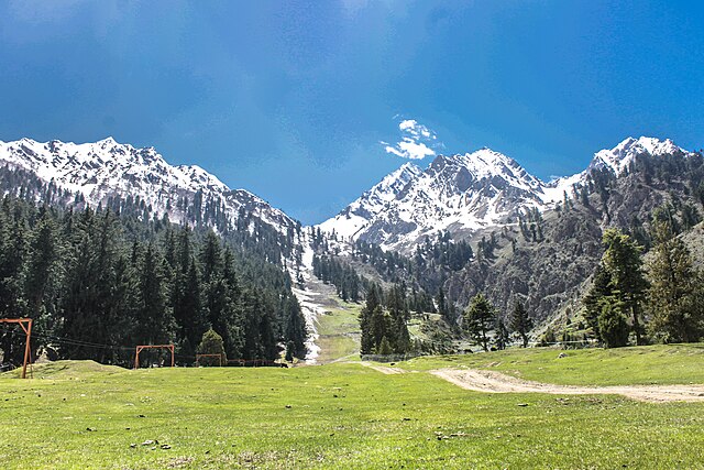
Naltar Valley ranks tenth, closing this list as Gilgit district’s most distinct alpine landscape, known for pine forests, glacial lakes, and Pakistan’s main ski resort. The valley sits roughly 2 hours from Gilgit city, with the base village around 3,050 meters and the upper lakes reaching closer to 3,962 meters.
Naltar Lakes, a cluster of small glacial pools known locally for shifting blue and green color depending on light and season, sit above the main village and require either a jeep or a moderate hike to reach. Naltar Ski Resort, Pakistan’s only operational ski facility with a chairlift, runs its season from roughly January through March, hosting national skiing competitions most winters.
Road conditions split sharply by season: the lower road from Gilgit to Naltar village is paved and manageable in a standard vehicle, but the continuation toward the lakes requires 4×4 transport and is impassable after heavy snow or during spring snowmelt. Confirm current road status with a local operator before driving beyond the village, since conditions change quickly at this elevation.
Pine and juniper forest covers much of the lower valley, turning gold and rust through October, which makes Naltar one of the few Gilgit-Baltistan destinations with a strong dedicated autumn season alongside its summer lake season. Wooden guesthouses in Naltar village offer the main lodging option, with Gilgit city as the practical base for most day-trip visitors.
Best season splits in two: March and April for skiing, and June through October for the lakes and forest scenery, with September and October favored for color. Travel time is approximately 2 hours by road from Gilgit, plus jeep time to reach the upper lakes. Naltar suits adventure travelers, skiers in winter, and photographers chasing autumn forest color outside the cherry-blossom-dominated Hunza season.
Which Place Is Best for First-Time Travelers?
Hunza Valley suits first-time travelers best, since it combines paved roads, varied hotels, and short distances between major sights. The comparison below sets Hunza against four other leading destinations to clarify which fits different trip styles and comfort levels.
| Destination | Road Access | Trekking Required | Hotel Variety | Altitude Risk | Best For |
|---|---|---|---|---|---|
| Hunza Valley | Fully paved | None | High (budget to luxury) | Low (2,438 m) | First-time travelers, families, couples |
| Skardu | Paved, flight available | Optional (treks start here) | High | Low–moderate (2,228 m) | Mixed groups, base for further trekking |
| Fairy Meadows | Jeep track + trek required | Yes (5 km trek) | Low (huts, camping) | Moderate (3,300 m) | Trekkers, adventure travelers |
| Deosai National Park | 4×4 jeep required | Minimal, but remote | Very low (camping only) | Moderate–high (4,114 m avg.) | Wildlife photographers, campers |
| Naltar Valley | Paved to village, jeep beyond | Optional short hikes | Low | Low–moderate (3,050–3,962 m) | Skiers, adventure travelers, photographers |
Hunza requires no jeep transfer, no trek, and no significant altitude adjustment, which removes the three biggest friction points for someone visiting Gilgit-Baltistan for the first time. Skardu works as a close second choice, particularly for travelers who want the option of adding a Deosai day trip without committing to a full trekking itinerary from the start. Fairy Meadows and Deosai reward travelers with at least one prior high-altitude trip, since both demand physical effort and tolerance for basic facilities. Naltar fits a narrower group: skiers in winter, or adventure travelers chasing forest scenery outside peak Hunza season.
Best Time to Visit Each Destination
Road openings, cherry blossoms, and snowfall vary enough across Gilgit-Baltistan’s districts that a single “best season” answer does not apply to the whole region. The month-by-month table below breaks down conditions destination by destination.
| Month | Hunza Valley | Skardu | Fairy Meadows | Deosai | Khunjerab Pass | Naltar |
|---|---|---|---|---|---|---|
| January–February | Closed to most tourism, snow | Cold, limited access | Closed (snow) | Closed (snow) | Closed | Ski season begins |
| March | Snowmelt begins | Roads reopening | Still closed | Closed | Closed | Peak ski season |
| April | Cherry and apricot blossoms | Opens for travel | Jeep track may reopen late April | Closed | Closed | Ski season ends, lakes thawing |
| May | Lush green, fewer crowds | Good weather begins | Open, fewer crowds | Closed (opens mid-June) | Opens (weather permitting) | Lakes accessible, green valley |
| June | Peak season starts | Peak season | Open, wildflowers | Opens mid to late month | Open | Green season, good access |
| July | Warm, busy | Warm, busy | Open, landslide risk after rain | Peak wildflowers and wildlife | Open | Green season |
| August | Warm, busy | Warm, busy | Open, landslide risk after rain | Peak wildflowers and wildlife | Open | Green season |
| September | Clear skies, early color | Clear skies | Open, cooling | Late-season access | Open | Early autumn color |
| October | Peak autumn foliage | Good weather, cooling | Closing by end of month | Closes by late month | Open cold at altitude | Peak autumn color |
| November | Closing for winter | Cold, snow at altitude | Closed | Closed | Closes on november 30 | Closed beyond village |
| December | Snow, limited access | Snow, limited access | Closed | Closed | Closed | Ski season preparation |
Hunza’s two color seasons bookend the calendar: April delivers cherry and apricot blossoms across Karimabad’s terraces, while October brings the valley’s autumn foliage peak. Skardu and Deosai share a tighter usable window, since Deosai’s road only opens reliably from mid-June and closes by late October regardless of conditions elsewhere in the region. Khunjerab Pass has no fixed opening date and depends entirely on snow clearance, so calling ahead before a Sost-to-pass day trip is worth the effort. Naltar runs on an inverted calendar compared to the rest of the list, peaking for skiing in March while most other destinations remain snowbound.
Suggested 7-Day and 10-Day Itineraries
A 7-day trip covers Hunza and Skardu without rushing, while a 10-day trip adds Fairy Meadows or Deosai for travelers willing to handle jeep transfers and basic camping. Both itineraries assume a flight into Islamabad and a flight to Gilgit or Skardu to save road time.
This Hunza and Skardu travel guide helps visitors combine both regions into one efficient itinerary.
7-Day Itinerary: Hunza and Skardu
Day 1: Fly Islamabad to Gilgit (1h15), drive 2.5 hours to Karimabad, Hunza. Overnight Karimabad.
Day 2: Visit Baltit Fort and Altit Fort in the morning; drive to Duikar for sunset. Overnight Karimabad.
Day 3: Day trip to Attabad Lake (1h drive) for boating, continue to Passu Cones and Hussaini Bridge. Overnight Karimabad.
Day 4: Drive Gilgit to Skardu via the Skardu Road (5–6 hours), stopping at the Indus-Gilgit confluence viewpoint. Overnight Skardu.
Day 5: Visit Shigar Fort (45 minutes from Skardu) and the Cold Desert; afternoon at Upper and Lower Kachura Lakes. Overnight Skardu.
Day 6: Day trip to Deosai National Park (2.5 hours each way), focused on Sheosar Lake. Overnight Skardu.
Day 7: Fly Skardu to Islamabad (1h10, weather permitting).
Driving hours total roughly 8.5–9.5 hours across the week, concentrated on Days 4 and 6.
10-Day Itinerary: Hunza, Skardu, and Fairy Meadows
Days 1–3: Follow the 7-day Hunza schedule above, adding a half-day in Gojal for Khunjerab Pass on Day 3 if road conditions allow (3 hours each way from Karimabad).
Day 4: Drive Gilgit to Skardu (5–6 hours). Overnight Skardu.
Day 5: Shigar Fort, Cold Desert, Kachura Lakes. Overnight Skardu.
Day 6: Deosai National Park day trip or overnight camp at Sheosar Lake for stargazing. Overnight Deosai or Skardu.
Day 7: Drive Skardu to Gilgit (5–6 hours), continue toward Raikot Bridge if time allows, or overnight in Gilgit.
Day 8: Drive to Raikot Bridge (2–3 hours from Gilgit), transfer to jeep for Tattu, trek to Fairy Meadows (3–4 hours). Overnight Fairy Meadows.
Day 9: Trek to Nanga Parbat viewpoint or Beyal Camp, return to Tattu and Raikot Bridge by jeep, drive to Gilgit. Overnight Gilgit.
Day 10: Fly Gilgit to Islamabad (1h15).
This 10-day version adds roughly 13–15 hours of driving and a half-day trek beyond the 7-day plan, so travelers prone to motion sickness or limited on time should default to the shorter itinerary and treat Fairy Meadows as a separate future trip.
Travel Costs and Budget Guide
A mid-range 7-day Hunza-and-Skardu trip for one traveler runs roughly PKR 90,000–160,000 (about USD 320–570), excluding international airfare to Islamabad. The table below breaks down typical costs by category for budget, mid-range, and comfort-tier travel.
| Category | Budget (PKR/day) | Mid-Range (PKR/day) | Comfort (PKR/day) |
|---|---|---|---|
| Hotel/guesthouse | 3,000–5,000 | 8,000–15,000 | 20,000–40,000+ |
| Meals (3 meals) | 1,500–2,500 | 3,000–5,000 | 6,000–10,000 |
| Local jeep/transport | 2,000–4,000 | 4,000–8,000 | 8,000–15,000 (private vehicle) |
| Fuel (private vehicle, per 100 km) | — | 2,500–3,500 | — |
| Domestic flight (one way, Islamabad–Gilgit or Skardu) | 15,000–25,000 | 15,000–25,000 | 15,000–35,000 (flexible fare) |
| National park entry (Deosai, Khunjerab) | 500–2,000 per site | 500–2,000 per site | 500–2,000 per site |
| Fort entrance fees (Baltit, Altit, Shigar) | 300–1,600 per site | 300–1,600 per site | 300–1,600 per site |
| Fairy Meadows jeep round trip | 7,500–8,500 (shared up to 5 people) | Same | Same |
Foreign visitors typically pay higher entry fees than Pakistani nationals at forts and national parks, sometimes three to five times the local rate; budget for this difference when planning Baltit Fort, Altit Fort, Deosai, and Khunjerab visits specifically. Deosai’s fishing permit at Bara Pani runs around PKR 500, separate from the park entry fee. Domestic flights to Gilgit and Skardu are frequently delayed or cancelled due to weather, so building a road-travel contingency into the budget is standard practice rather than an exception. Private 4×4 vehicle rental with a driver, common for multi-destination trips, runs roughly PKR 15,000–25,000 per day depending on the vehicle and route.
Road Conditions and Transportation
The Karakoram Highway (N-35) is the backbone of Gilgit-Baltistan’s road network, fully paved from Islamabad through Gilgit to Sost near the Chinese border. Most major destinations on this list, including Hunza, Attabad Lake, and Khunjerab Pass, sit directly on or just off the KKH.
Skardu Road, branching from the KKH near Jaglot, connects Gilgit to Skardu in roughly 5–6 hours over a fully paved but narrower route with frequent landslide-prone stretches, particularly during and after monsoon rain in July and August. The Babusar Pass route, an alternative from Naran in Kaghan Valley into Chilas, sits above 4,100 meters and is open only from late June through October due to snowfall; it offers a shorter path from Islamabad toward Diamer district but is unsuitable in shoulder season.
Flights connect Islamabad to both Gilgit and Skardu, taking roughly 1 hour 10 to 15 minutes each way through PIA’s domestic network. These flights are weather-dependent and subject to frequent delay or cancellation, since the route crosses some of the highest terrain on any scheduled commercial flight in the world; travelers should avoid booking same-day connections immediately after a Gilgit or Skardu flight.
Public transport runs primarily via NATCO buses from Islamabad to Gilgit and onward to Hunza, taking 16–20 hours depending on road conditions, with fares well below private hire. Local transport within valleys relies on shared jeeps (Suzuki vans called “Coasters” or hired Hilux jeeps) rather than fixed bus routes, particularly for unpaved sections like the Fairy Meadows jeep track or Deosai’s interior roads.
Fuel availability is reliable along the KKH itself but limited in side valleys like Naltar or deep into Deosai, so filling a vehicle’s tank in Gilgit or Skardu before a side trip is standard local practice. Road closures from landslides or snow can isolate Hunza, Skardu, or Diamer for hours to days; checking the National Highway Authority’s KKH status updates before departure is worth the few minutes it takes.
Safety Tips Before Visiting Gilgit-Baltistan
- Altitude sickness is a real risk above 3,000 meters, relevant at Fairy Meadows (3,300 m), Deosai (4,114 m avg.), and Khunjerab Pass (4,693 m); ascend gradually, hydrate, and avoid alcohol the day before reaching high elevation.
- Weather changes fast at altitude; even mid-summer nights at Deosai or Fairy Meadows drop to near freezing, so pack layers regardless of the season you travel in.
- Road closures from landslides or snow are common on the Skardu Road, the Fairy Meadows jeep track, and Babusar Pass; build at least one buffer day into any itinerary that depends on these routes.
- Permits are required for Khunjerab National Park entry and for Deosai National Park; carry your CNIC or passport and confirm current fees at the checkpost, since rates change between seasons.
- Mobile networks are unreliable or absent inside Deosai National Park and along stretches of the Fairy Meadows trek; download offline maps and inform your hotel or guide of your planned route before heading out.
- Foreigners should keep photocopies of their passport and Pakistani visa accessible, since checkpoints along the KKH and at national park entrances commonly request identification.
- Jeep tracks like Fairy Meadows and parts of Deosai are legally restricted to local licensed drivers; do not attempt to drive these sections in a rented or private vehicle.
- Hydration and sun exposure matter more than expected at high altitude; UV intensity at Deosai and Khunjerab is significantly higher than at sea level even on cloudy days.
- Emergency contacts worth saving before departure include Pakistan’s Rescue 1122 service, active in Gilgit-Baltistan for road and medical emergencies.
This is a sensitive topic for some travelers managing existing health conditions at altitude; if you have a heart or respiratory condition, consult a doctor before planning travel above 3,000 meters, and consider travel insurance that covers helicopter evacuation for routes like Fairy Meadows or Deosai.
Map of the Top 10 Places
The ten destinations on this list group into four geographic clusters that map naturally onto a single road trip. The Hunza cluster, covering Karimabad, Baltit Fort, Altit Fort, Attabad Lake, and Khunjerab Pass, runs north along the Karakoram Highway through Hunza and Gojal sub-districts. The Gilgit cluster, just south of Hunza, contains Naltar Valley and serves as the road and flight hub connecting every other cluster. The Skardu cluster, reached via Skardu Road, groups Skardu city itself, Upper Kachura Lake, and the Deosai approach. The Diamer cluster, furthest south along the KKH toward Chilas, contains Fairy Meadows and the Babusar Pass route.
A practical loop runs Gilgit to Hunza (2.5 hours north), back through Gilgit to Skardu (5–6 hours), and then south to Fairy Meadows via Raikot Bridge if time allows, avoiding unnecessary backtracking on the KKH.
Frequently Asked Questions
1. What is the best month to visit Gilgit-Baltistan overall?
April and October give the strongest combined results across destinations: April brings Hunza’s cherry blossoms with manageable crowds, while October adds autumn foliage in Hunza and Naltar alongside still-open roads to Skardu.
2. Do I need a permit to visit Gilgit-Baltistan as a foreigner?
No general NOC is required for most of Gilgit-Baltistan as of 2026, including Hunza, Skardu, and Fairy Meadows, though Khunjerab National Park and Deosai National Park require separate entry permits issued at their checkposts. Regulations can change, so confirm current requirements with the Ministry of Interior or a local tour operator within 30 days of travel.
3. How long does it take to drive from Islamabad to Hunza?
The drive takes 16–19 hours along the Karakoram Highway, typically split across two days with an overnight stop in Besham or Chilas. Flying to Gilgit cuts this to roughly 1 hour 15 minutes plus a 2.5-hour onward drive.
4. Is Skardu or Hunza better for a first trip?
Hunza suits most first-time visitors better due to fully paved access, varied hotels, and no altitude adjustment, while Skardu suits travelers who want the option of adding Deosai or a multi-day trek to their trip.
5. Can Deosai National Park be visited as a day trip from Skardu?
Yes, Deosai is commonly visited as a day trip, roughly 2.5 hours each way by 4×4 jeep from Skardu, though an overnight camp near Sheosar Lake adds stargazing and better wildlife visibility at dawn.
6. How dangerous is the Fairy Meadows jeep track?
The 15-kilometer jeep track from Raikot Bridge to Tattu village is narrow, unpaved, and cliff-edged, and has been cited among the world’s more hazardous mountain roads; it is operated exclusively by experienced local drivers, which significantly reduces real-world risk for passengers.
7. What is the elevation of Khunjerab Pass, and is altitude sickness a concern?
Khunjerab Pass sits at 4,693 meters, the highest paved international border crossing in the world, and altitude sickness is a genuine concern; most visitors limit their stay at the pass to under an hour and avoid strenuous activity there.
8. When does the road to Khunjerab Pass close for winter?
There is no fixed annual date; the pass typically closes by November and reopens between April and May depending on snowfall, so calling ahead before a Khunjerab day trip in shoulder-season months is advisable.
9. Are Baltit Fort and Altit Fort worth visiting on the same day?
Yes, both forts sit within a 10-minute drive of each other in Hunza district, and a combined visit with lunch at Altit’s Royal Garden typically takes 4–5 hours including guided tours of both.
10. What is the best way to see Naltar Valley’s lakes?
A 4×4 jeep from Naltar village is required to reach the upper lakes, since the road beyond the village is unpaved and seasonally affected by snowmelt; June through October offers the most reliable access.
11. Is it safe to swim or boat at Attabad Lake?
Boating is widely available and considered safe with licensed operators and life jackets; swimming is technically possible but not recommended due to the lake’s depth, cold temperature, and lack of lifeguard coverage.
12. How many days should I budget for a Gilgit-Baltistan trip that includes Fairy Meadows?
Ten days gives enough buffer for road delays, the Fairy Meadows jeep transfer and trek, plus time in both Hunza and Skardu; a trip under 7 days should generally skip Fairy Meadows given its access time.
Conclusion
These are the best places to visit in Gilgit-Baltistan for first-time visitors, photographers, families, and adventure travelers alike; Hunza Valley, Skardu, and Fairy Meadows anchor any serious trip through Gilgit-Baltistan, each representing a different mountain identity within the same province. Deosai, Attabad Lake, Khunjerab Pass, the Hunza forts, Upper Kachura Lake, and Naltar Valley round out a list built for real trip planning rather than browsing.
Start with the 7-day Hunza-and-Skardu itinerary if this is a first visit, and extend to 10 days once Fairy Meadows or a Deosai overnight fits your schedule and fitness level. Confirm road and permit conditions close to your travel date, since access to Khunjerab Pass, Deosai, and the Fairy Meadows jeep track shifts with the season.
Plan Your Gilgit-Baltistan Trip with Northern Discover
Plan your Gilgit-Baltistan trip with Northern Discover — WhatsApp us at +923419674740 or email northerndiscover.pk@gmail.com. Our local team can help you arrange customized tours, private transport, experienced drivers, hotel bookings, trekking support, and complete travel itineraries across Hunza, Skardu, Fairy Meadows, Deosai National Park, and other destinations throughout Gilgit-Baltistan.
Gilgit-Baltistan is renowned for its breathtaking landscapes and diverse natural beauty. This article highlights the Top 10 Beautiful Places to Visit in Gilgit-Baltistan, showcasing the region’s stunning valleys, majestic mountains, and vibrant culture.