
Astore Valley : What Are the Best Places to Visit in Astore Valley?
| Attraction | Distance from Astore | Jeep Required |
| Rama Meadows / Rama Lake | 10–11 km | Yes |
| Rupal Valley (via Tarishing) | 30 km | Yes |
| Minimarg | 39 km | Yes |
| Domel | ~35 km | Yes |
| Rainbow Lake | ~36 km | Yes |
| Sheosar Lake | ~46 km (via Chilam) | Yes |
| Gorikot | ~16 km | Car or Jeep |
| Mazino Pass | 60+ km, multi-day trek | Trekking only |
Astore Attractions at a Glance
| Attraction | Altitude | Distance from Eidgah | Jeep Required | Visit Duration | Best Season |
| Rama Meadows | ~3,200 m | 10–11 km | Yes | Half day | June–September |
| Rama Lake | ~3,300 m | 12 km (via Rama Meadows) | Yes | Half day | June–September |
| Rupal Valley / Tarishing | 2,911 m | 30 km | Yes | Full day | June–September |
| Minimarg | 2,845 m | 39 km | Yes | Full day | July–August |
| Domel | ~2,700 m | ~35 km | Yes | Stopover | July–August |
| Rainbow Lake | ~2,750 m | ~36 km | Yes | Half day | July–August |
| Sheosar Lake | 4,250 m | 46 km | Yes | Full day | July–August |
| Chilam | 3,800 m | ~25 km | Yes | Stopover | June–September |
| Gorikot | ~2,500 m | 16 km | Car or Jeep | Stopover | May–October |
| Harcho Valley | ~2,400 m | Entry point from Gilgit side | Car | Stopover | May–October |
| Mazino Pass | 5,399 m | 60+ km trek from Tarishing | Trekking, guide required | 2–3 days | July–August |
Rama Meadows – Top Places to Visit in Astore Valley
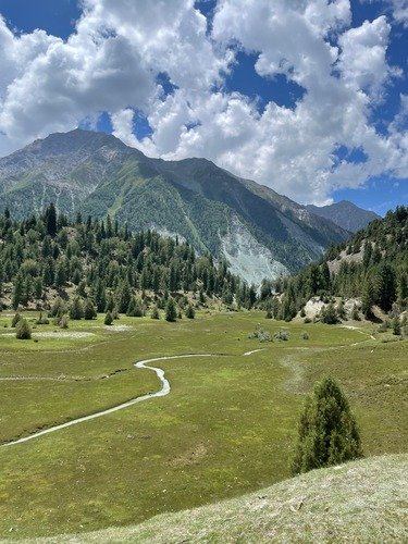
Rama Meadows is located about 11 km from Eidgah at an elevation of approximately 3,200–3,300 meters above sea level , at a higher altitude than Eidgah itself. Jeeps take about 90 minutes to reach the meadows on a track suitable only for 4×4 vehicles. The meadows offer direct views of the Nanga Parbat massif without any trekking required.
Activities include short walks among pine groves, horseback rides arranged through local operators, and picnicking near the open grazing fields. Camping is common at Rama Meadows between June and September, with designated flat areas near the main meadow used by local tour operators.
The road from Astore climbs steadily, with several switchbacks that demand an experienced driver. Photographers favor early morning light, when cloud cover over Nanga Parbat is typically lowest. Rama Meadows works well for families, since the jeep track avoids the longer and rougher legs found past Tarishing or Chilam.
No fixed GPS marker exists locally, so drivers navigate by the Rama checkpoint at the meadow entrance.
Rama Lake
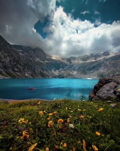
Rama Lake sits beyond Rama Meadows, roughly an hour’s walk or short jeep extension past the main meadow camp. Hiking from the meadows to the lake takes 45 minutes to an hour on a clear forest trail. The lake itself stays cold year-round, fed by glacial runoff from the surrounding ridgeline.
Camping at the lake edge is permitted, and many groups choose this over the meadows for quieter surroundings. Photography here works best at midday, when the lake reflects the peaks without morning shadow cover.At Rama Lake, afternoon clouds often develop after 1:00 pm during July and August, reducing mountain visibility for photographers .
Travelers should plan the lake visit as a half-day extension of the Rama Meadows trip, not a separate outing. Local guides in Astore bazaar can arrange combined Rama Meadows and Rama Lake jeep packages.
Rupal Valley
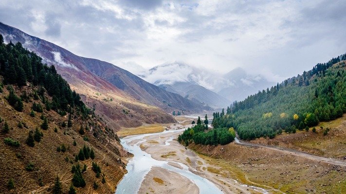
Rupal Valley opens south of Nanga Parbat and is reached through Tarishing village, about 30 km from Astore. The valley leads directly to the Rupal Face, the highest vertical mountain wall on Earth at roughly 4,500 meters of rise from valley floor to summit. The jeep road from Astore to Tarishing takes about two hours over an unpaved, uneven surface.
Beyond Tarishing, access becomes trekking-only, following the Tarishing Glacier’s lateral moraine toward Rupal village and Herligkoffer Base Camp. Viewpoints along the lower valley near Tarishing already offer a clear look at the southern face without requiring a multi-day trek.
Beyond Tarishing, the jeep track toward the Rupal trailhead becomes rough, with loose gravel and narrow sections unsuitable for ordinary cars . Rupal Valley sees far fewer visitors than Fairy Meadows on the mountain’s northern side, making it a quieter option for serious trekkers.
Tarishing Village
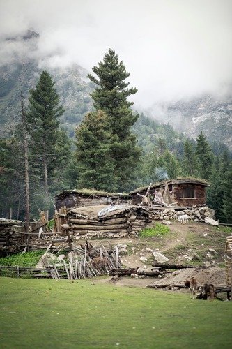
Tarishing functions as the gateway to both the Rupal Face and the Nanga Parbat Base Camp trek route. The village sits at roughly 2,911 meters and holds around 200 residents, making it the last settlement reachable by jeep in this direction. Basic guesthouses operate here, alongside a small medical center and a handful of local shops.
Most trekkers overnight in Tarishing before starting the multi-day walk toward Herligkoffer Base Camp the following morning. Jeep access from Astore takes about two hours, while a direct hire from Gilgit can take significantly longer depending on road conditions.
Tarishing also serves climbers heading toward Rupal Peak and the technical Mazino Pass crossing. Travelers without trekking plans can still use Tarishing as a day-trip base for southern Nanga Parbat viewpoints.
Minimarg Valley
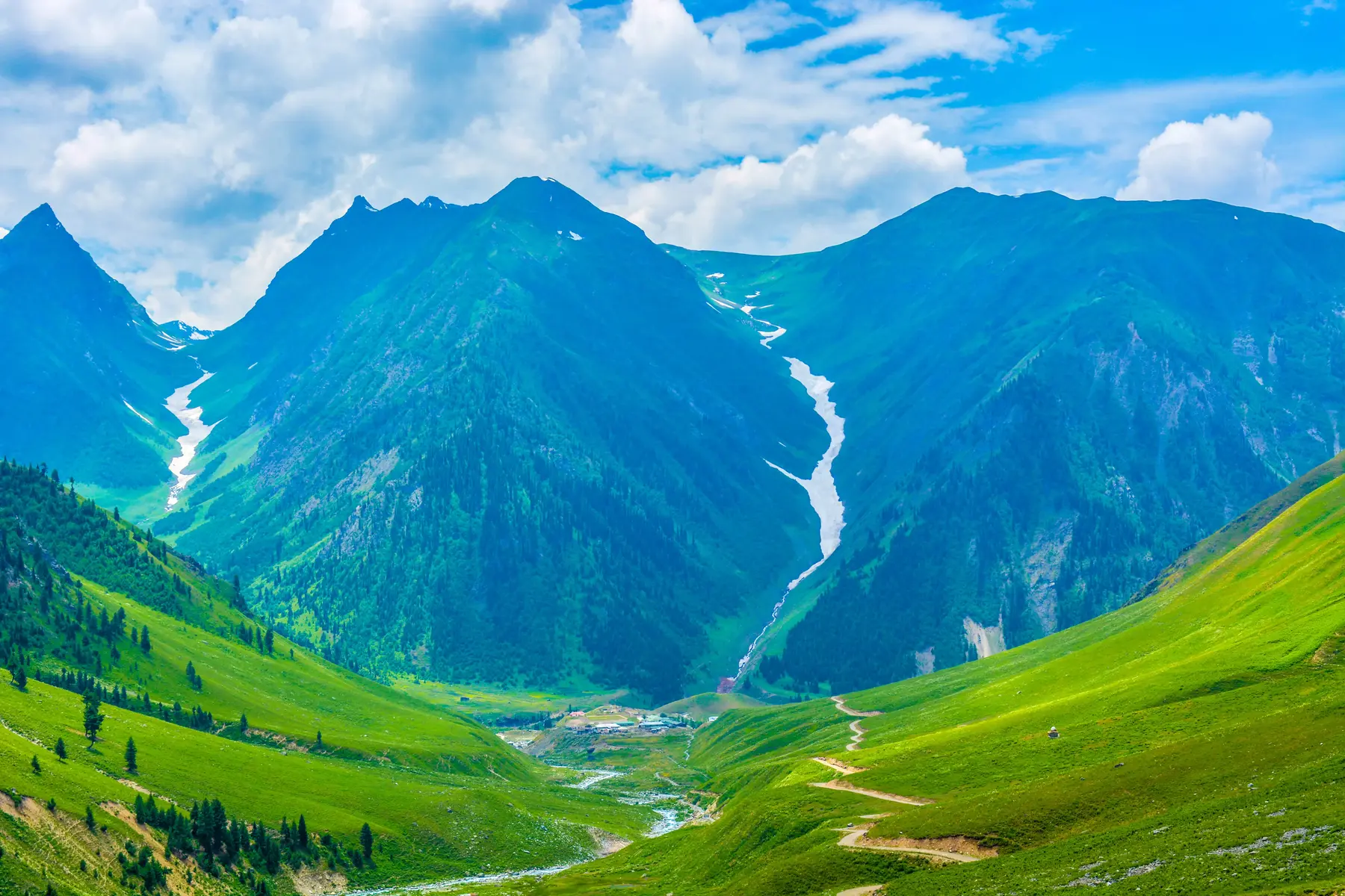
Minimarg sits at 2,845 meters, about 39 km from Astore, reached via the Burzil Pass route through Chilam checkpoint. The drive takes 3 to 4 hours one way on a rough track suitable only for 4×4 jeeps. Because Minimarg lies near the Line of Control with Indian-administered Kashmir, travelers should confirm current access rules with the Astore tourism office before planning a visit, as some stretches fall under Pakistan Army administration.
The best season for Minimarg runs through July and August, when snow clears from the Burzil approach. Grassy slopes, pine forests, and the Neelum (Kishenganga) riverbank define the valley’s landscape. Minimarg connects directly to Domel and onward to the Rainbow Lake area, making it efficient to combine all three in a single full-day trip. Accommodation here remains limited to basic guesthouses, so most visitors plan a day trip rather than an overnight stay.
Domel
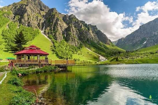
Domel sits along the route between Minimarg and the Rainbow Lake area, roughly 35 km from Astore town. The settlement offers river views and serves mainly as a transit stop rather than a standalone destination. Camping is possible beside Rainbow Lake, but most travelers visit it during a full-day itinerary covering Minimarg, Domel, and Nagai.
Travel advice for this stretch includes carrying extra fuel, since no filling stations operate beyond Chilam checkpoint. The road past Domel toward Rainbow Lake narrows considerably, requiring slow, careful driving even in dry conditions.
Most itineraries pair Domel with Minimarg and Rainbow Lake as a single connected day trip from Astore. Distance and road conditions make an overnight stay unnecessary for most travelers using Domel only as a waypoint.
Rainbow Lake: A Stunning Destination Among Places to Visit in Astore Valley
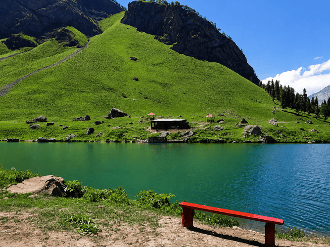
Among the most unique places to visit in Astore Valley, Rainbow Lake sits near the small settlement of Nagai on the route toward Domel, within the wider Minimarg area. The lake takes its name from the shifting color pattern visible in its water through the day, caused by algae and mineral content.
Reaching the lake requires the same jeep route used for Minimarg, adding a short detour near Nagai’s wooden-hut cluster. Best months for a visit run from July through August, matching the Minimarg access window through Burzil Pass.
Camping near the lake is possible, though most visitors treat it as a stop within a longer Minimarg day trip rather than an overnight base. The trekking distance from the main jeep track to the lakeshore is short, typically under 30 minutes on foot. Mineral content in the water shifts visibly between morning and afternoon light, which photographers should plan around.
Sheosar Lake from Astore Side
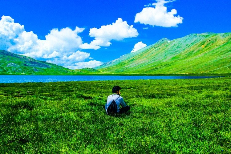
If you want to experience a high-altitude alpine lake, Sheosar Lake is another spectacular destination included in the top places to visit in Astore Valley from the Astore side Sheosar Lake sits inside Deosai National Park, reached from Astore via the Chilam checkpoint route rather than the Skardu approach. The lake lies about 16 km from Chilam and roughly 46 km from Astore town, at an elevation near 4,250 meters. Sheosar measures 2.3 km long and 1.8 km wide, with a maximum depth of about 40 meters.
The name comes from Shina language words meaning “blind lake.” A 4×4 jeep is required for the full route, since the Deosai plateau road remains unpaved and exposed to weather throughout. Wildlife sightings here include the Himalayan brown bear, golden marmots, and migratory birds during the summer months. The lake freezes completely from November through May, so visits are only practical between July and September.
Chilam
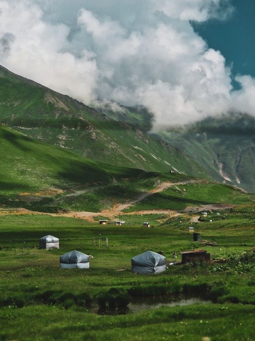
Chilam, also called Chillum Chowki, marks the last village in Astore District before the road continues toward Deosai and Minimarg. A police checkpoint here gives the settlement its local name, and travelers must register before continuing further. Fuel availability is limited beyond this point, so drivers typically top up tanks in Astore town before reaching Chilam.
The settlement sits at roughly 3,800 meters and includes grazing fields, small streams, and a handful of basic hotels for overnight stops. Chilam functions as the junction point for two separate routes: south toward Sheosar Lake and Deosai, and north toward Minimarg via Burzil Pass.
Road conditions past Chilam worsen on both branches, with sharp ascents requiring low-gear driving. Most travelers treat Chilam as a checkpoint stop rather than a destination, refueling and continuing within the same day.
Gorikot
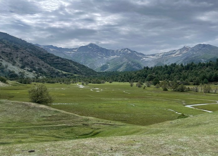
Gorikot functions as the largest valley and a key administrative point within Astore District, serving as a gateway toward both Tarishing and Deosai. The settlement sits roughly 16 km from Astore town, with roads suitable mainly for jeeps though passable by careful car drivers.
Gorikot’s economy centers on fruit and vegetable cultivation, visible in the terraced fields along the valley floor. Historically, the area served as a waypoint along trade routes connecting Gilgit-Baltistan with Kashmir.
Local villages here maintain agricultural traditions distinct from the more tourism-focused settlements near Rama and Tarishing. Accommodation options exist for travelers staging an early departure toward Deosai or the Nanga Parbat base camp routes. Most visitors pass through Gorikot rather than stopping for an extended visit, given its role as a transit hub.
Harcho Valley
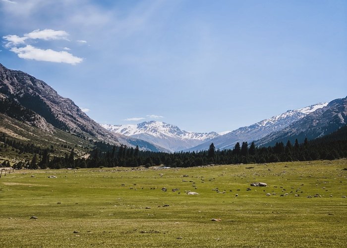
Harcho Valley marks the entry point into Astore Valley when approaching from the Gilgit side via Jaglot. The Harcho Glacier here ranks as the nearest glacier to the valley entrance, distinct from the more remote Siachen Glacier at the valley’s far end. Accessibility is straightforward, since the main Astore Valley Road passes directly through this stretch.
Camping options exist along the glacier’s lower reaches, though most travelers pass through without stopping given proximity to Astore town itself. Harcho Glacier feeds meltwater into the Astore River, creating several roadside viewpoints along the Jaglot–Astore Road. Harcho Valley works well as a brief stop for travelers wanting a first glimpse of glacial terrain before reaching the main valley.
Mazino Pass
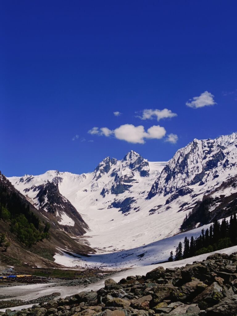
Mazino Pass sits at 5,399 meters, forming the highest and most technical point on the Around Nanga Parbat trekking route. The pass connects Rupal Valley’s southern side to the Diamir side of the mountain, requiring multiple days of trekking from Tarishing.
Suitability is limited to experienced trekkers, since the descent involves a steep drop requiring fixed-rope rappelling on the far side. Seasonal access runs from July through August only, when snow conditions on the approach stabilize enough for safe crossing.
Trekkers typically reach Mazino Base Camp around 4,050 meters before pushing to a high camp near 4,700 meters ahead of the final push. A licensed mountain guide is required for this route, and solo attempts are strongly discouraged given the technical terrain. Mazino Pass remains a specialist destination, not a general sightseeing stop for typical Astore Valley visitors.
Dashkin Village & Forest: A Hidden Green Gem in Astore
Dashkin Village sits along the main Jaglot–Astore Highway, roughly 22 kilometers before reaching Astore town. The village is positioned at an altitude of approximately 2,450 meters above sea level. This destination is highly regarded for its dense pine and cedar forests, which stand out in contrast to the rocky terrain found near the valley’s entrance.
The local community relies heavily on traditional agriculture, harvesting terraced fields of potatoes, maize, and local fruits. Visitors can explore the village walking paths that wind through ancient wooden houses and freshwater springs feeding into the lower valley. The forest area surrounding the village serves as a habitat for local wildlife, including various species of Himalayan birds and small mammals.
Travelers usually treat Dashkin as a brief stopover or a peaceful day trip from Astore town, as the main road runs directly parallel to the settlement. Standard cars can easily reach the village center during the summer months, making a specialized 4×4 vehicle unnecessary for this specific stretch. Basic tea stalls and local shops operate near the main roadside entrance, providing refreshments for passing tourists.
Gudai Valley: The Trout Fishing Hub of Astore
- Jaglot Bridge — the river’s confluence point with the Indus, a common photography stop before entering the valley road.
- Harcho Valley stretch — early glacial views with the river running parallel to the main road.
- Eidgah riverside — central viewpoint near the district headquarters, easy access without a jeep.
- Gorikot terraces — elevated views over the river against the surrounding fruit orchards.
- Domel confluence — narrower river views near the Minimarg route, best photographed in early morning light.
Most viewpoints between Jaglot Bridge and Gorikot require no permits, but vehicles should park completely off Astore Valley Road because traffic lanes are narrow.
Which Attractions Are Best for First-Time Visitors?
| Attraction | Family Travel | Scenery | Photography | Adventure Level |
| Rama Meadows | Excellent | High | High | Low |
| Rama Lake | Good | High | High | Low–Moderate |
| Gorikot | Excellent | Moderate | Moderate | Low |
| Minimarg & Rainbow Lake | Moderate | High | High | Moderate |
| Sheosar Lake | Limited | High | High | Moderate |
| Rupal Valley / Tarishing | Limited | Very High | Very High | High |
| Mazino Pass | Not suitable | Very High | High | Very High |
First-time visitors and families should prioritize Rama Meadows and Gorikot, both reachable within two hours of Astore town. Travelers seeking dramatic mountain photography without trekking should add Tarishing as a day trip, stopping short of the technical routes beyond.
Suggested 1-Day, 2-Day and 3-Day Sightseeing Itineraries
To help you plan your trip to these amazing places to visit in Astore Valley, here are a few suggested itineraries based on your tour duration
1-Day Itinerary: Depart Astore early for Rama Meadows, a 90-minute jeep ride. Spend two hours at the meadows, then hike to Rama Lake for one additional hour. Return to Astore by early afternoon, total driving and walking time under 6 hours.
2-Day Itinerary: Day one covers Rama Meadows and Rama Lake as above, with an overnight camp at the meadows. Day two heads to Tarishing via Astore, a two-hour jeep drive, with a half-day exploring Rupal Valley viewpoints before returning to Astore by evening.
3-Day Itinerary: Day one: Rama Meadows and Rama Lake. Day two: Astore to Chilam (1.5 hours) and onward to Sheosar Lake (additional 2 hours), returning to Chilam for an overnight stop. Day three: Chilam to Minimarg via Burzil Pass (3–4 hours), with a stop at Rainbow Lake and Domel before returning to Astore by late evening.
Best Time to Visit Each Attraction
| Attraction | Jun | Jul | Aug | Sep | Notes |
| Rama Meadows / Lake | Open | Open | Open | Open | Most reliable year-round summer access |
| Rupal Valley / Tarishing | Open | Open | Open | Partial | Glacier crossings get harder after early September |
| Minimarg / Rainbow Lake | Limited | Open | Open | Limited | Burzil Pass snow clears late June |
| Sheosar Lake | Limited | Open | Open | Limited | Lake frozen November through May |
| Mazino Pass | Closed | Open | Open | Closed | Technical crossing window is narrow |
| Gorikot / Harcho Valley | Open | Open | Open | Open | Accessible by car most of the season |
Travel Tips for Visiting Astore Attractions
Traveling around Astore Valley requires preparation because services become limited beyond Astore town. Fuel stations are generally unavailable after Chilam, mobile signals disappear near Tarishing and Sheosar Lake, and ATMs exist only in Astore Bazaar. Travelers should carry cash, warm clothing, and hire experienced local jeep drivers for routes beyond Rama Meadows, especially when visiting Minimarg or Deosai.
- Fuel up fully in Astore town; stations beyond Chilam are unreliable or absent.
- ATMs exist only in Astore bazaar — carry sufficient cash for jeep hire and guesthouses beyond town.
- Mobile network coverage drops past Gorikot and disappears entirely near Tarishing and Sheosar Lake.
- Carry layered clothing because temperatures in Eidgah can exceed 20°C while Mazino Pass may remain below freezing during summer mornings.
- Basic food and tea stalls operate in Chilam, Gorikot, and Tarishing, but options thin out past these points.
- Prayer facilities are available in Astore town and at larger stopover villages like Gorikot and Chilam.
- Always confirm Deosai and Burzil Pass road status locally before departure, since conditions shift quickly with weather.
- Hire a local jeep driver familiar with the specific route rather than a general-purpose vehicle for any trip beyond Rama Meadows.
- When exploring these beautiful places to visit in Astore Valley, make sure to hire a local 4×4 jeep
Frequently Asked Questions
What are the best places to visit in Astore Valley?
The best places to visit in Astore Valley are Rama Meadows, Rama Lake, Rupal Valley, Tarishing, Minimarg, Domel, Rainbow Lake, Sheosar Lake, Chilam, Gorikot, Harcho Valley, and viewpoints along the Astore River. These attractions offer alpine meadows, mountain lakes, glacier views, and access to high-altitude trekking routes. Most are easiest to visit between June and September when roads are generally open.
Which attraction should first-time visitors visit first?
Rama Meadows is the best first destination for most visitors to Astore Valley. It is about 11 km from Eidgah, has a good summer road, and offers easy access to Rama Lake. Families, photographers, and first-time travelers can comfortably explore the meadow in a half-day or full-day visit.
How do I reach Rama Meadows?
You can reach Rama Meadows by driving about 11 km from Eidgah on a mountain road that normally takes 30 to 45 minutes. Cars can usually reach the meadow during summer, although road conditions vary after heavy rain. Start early in the morning for clearer weather and lighter traffic.
How far is Rama Lake from Rama Meadows?
Rama Lake is about 3 to 4 km from Rama Meadows and usually requires a 1.5 to 2-hour hike each way. The trail climbs steadily through alpine terrain before reaching the lake. Wear hiking shoes and carry drinking water because no permanent facilities are available along the route.
Can tourists visit Minimarg?
Yes, tourists can visit Minimarg when the road is open and travel requirements are met. The route normally operates from late May or June until early autumn, depending on weather and road conditions. Check the latest access status before departure because seasonal restrictions may change.
Do I need a 4×4 vehicle for Astore attractions?
A standard vehicle is suitable for some attractions, but a 4×4 is recommended for remote destinations such as Minimarg, Tarishing, Chilam, and parts of the Deosai route. Rough mountain roads become more challenging after rain or during the early season. Hiring a local jeep also reduces the risk of vehicle damage.
Can I enter Deosai National Park from Astore?
Yes, you can enter Deosai National Park from Astore through the Chilam route during the summer season. The road normally opens after snow clearance and closes again with winter snowfall. Entry fees and park regulations are collected at the official entrance checkpoint.
Which attraction has the best view of Nanga Parbat?
Rupal Valley offers the closest road-access view of the south face of Nanga Parbat. The drive through Tarishing brings visitors to one of the mountain’s most impressive viewpoints without technical climbing. Morning usually provides the clearest visibility before afternoon clouds develop.
How many days are needed to explore Astore Valley?
Three to five days are recommended to explore Astore Valley comfortably. This allows enough time to visit Rama Meadows, Rama Lake, Rupal Valley, Chilam, and other nearby attractions without rushing. Travelers planning to include Minimarg or Deosai should consider an additional day.
What is the best month to visit Astore Valley attractions?
June is generally the best month to visit Astore Valley because roads are usually open and mountain views are often clear. July and August also provide excellent access, while September offers cooler weather with fewer visitors. Winter snowfall closes many high-altitude routes.
Are there hotels near the main attractions?
Yes, hotels and guesthouses are available in Eidgah, Rama, and Tarishing, while camping is common near several remote attractions. Accommodation choices become limited beyond populated villages, especially toward Minimarg and Deosai. Booking ahead is recommended during the summer travel season.
Which attractions are suitable for families with children?
Rama Meadows, Rama Lake, Gorikot, and selected Astore River viewpoints are the most family-friendly attractions in Astore Valley. These locations have relatively easier access and shorter walking distances than remote trekking destinations. Families with young children should avoid long jeep tracks and high-altitude hikes during poor weather.
What is the closest attraction to Astore town?
Rama Meadows is the closest major attraction, about 10–11 km from Astore town. The jeep ride takes roughly 90 minutes one way on a track suitable only for 4×4 vehicles. Most day-trippers reach it before midday for clear mountain views.
Do I need a jeep to visit Astore Valley attractions?
Most remote attractions beyond Rama Meadows—including Tarishing, Chilam, Minimarg, and Sheosar Lake—require a 4×4 jeep because of rough mountain roads and seasonal conditions. Regular cars can reach Astore town and parts of Gorikot. Local jeep hire is available in Astore bazaar.
How do I get to Rupal Valley from Astore?
Drive about 30 km from Astore to Tarishing village, a two-hour jeep ride over an unpaved road. From Tarishing, Rupal Valley views begin immediately, with trekking required for routes further toward Herligkoffer Base Camp.
Is Minimarg open to tourists?
Minimarg sits near the Line of Control with Indian-administered Kashmir, and access can be restricted depending on current security conditions. Confirm status with the Astore tourism office before planning a trip. When open, it is reached via Burzil Pass.
How far is Sheosar Lake from Astore?
Sheosar Lake is about 46 km from Astore town, reached via the Chilam checkpoint route into Deosai National Park. The drive takes several hours over unpaved plateau roads. A 4×4 jeep is required for the full journey.
What is the best season to visit Astore Valley attractions?
July and August offer the most reliable access to every major attraction, including Minimarg, Sheosar Lake, and Mazino Pass. Rama Meadows and Gorikot stay accessible from June through September. Snow closes most higher routes outside this window.
Can families visit Rama Meadows and Rama Lake?
Rama Meadows and Rama Lake suit families well, with a short jeep ride and gentle walking trails. The route avoids the rougher terrain found past Tarishing or Chilam. Most families complete both sites within a single day trip.
What is Tarishing village known for?
Tarishing is known as the gateway village to the Rupal Face and Nanga Parbat Base Camp trekking route. It holds about 200 residents and offers basic guesthouses for overnight stays. Most multi-day treks toward Mazino Pass begin here.
Is Mazino Pass suitable for casual trekkers?
Mazino Pass is not suitable for casual trekkers, given its 5,399-meter altitude and a steep, rope-assisted descent. The crossing requires a licensed guide and prior high-altitude trekking experience. Access is limited to July and August only.
Where can I see Rainbow Lake?
Rainbow Lake sits near Nagai village on the route toward Domel, within the wider Minimarg travel area. It requires the same jeep route used for Minimarg, with a short walking detour to the lakeshore.
What is Chilam checkpoint used for?
Chilam, also called Chillum Chowki, is a police checkpoint marking the last village before routes split toward Deosai and Minimarg. Travelers register here before continuing. It also serves as the last reliable fuel and food stop on both routes.
Can I combine Domel, Rainbow Lake, and Minimarg in one trip?
Domel, Rainbow Lake, and Minimarg can be combined into a single full-day trip from Astore, since all three sit along the same Burzil Pass route. Total round-trip driving time runs 6 to 8 hours depending on road conditions.
Plan your Astore Valley attractions tour with Northern Discover — WhatsApp us at +923419674740 or email northerndiscover.pk@gmail.com