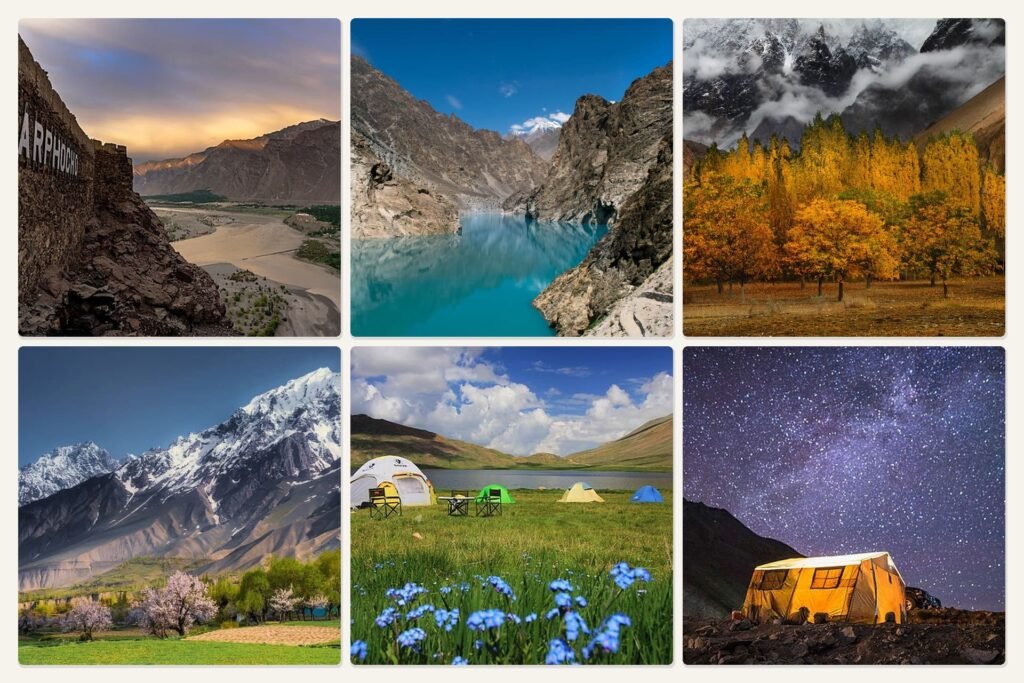
Concordia Pakistan Travel Guide: Trek Route, Cost, Best Time & K2 Views
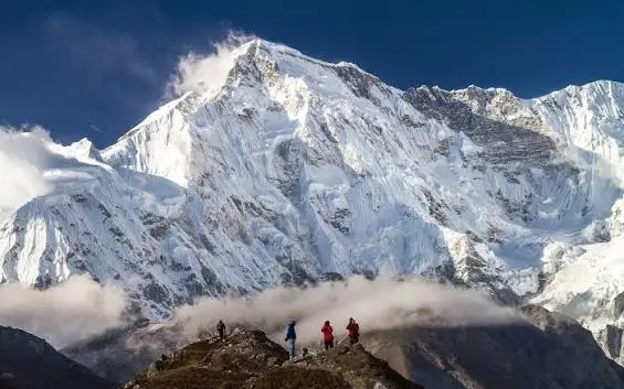
Concordia is the glacial junction in Pakistan’s Karakoram Range where the Baltoro Glacier meets the Godwin-Austen Glacier, sitting at roughly 4,600 to 4,691 meters (15,090–15,390 feet) in Gilgit-Baltistan’s Central Karakoram National Park. Reaching it requires an 8- to 10-day trek from Askole, following the Baltoro Glacier past Jhola, Paiju, Urdukas, and Goro II before the final approach. Trekkers who make the trip are rewarded with a single 360-degree view containing four peaks over 8,000 meters — K2, Broad Peak, Gasherbrum I, and Gasherbrum II — a concentration of giants unmatched anywhere else on Earth.
Quick answer: Concordia is not a village or a fixed camp with buildings — it is an open glacial amphitheater used as a seasonal campsite, reached only on foot or by helicopter charter, with no roads, no permanent structures, and no cell coverage for most of the route.
Concordia is famous because it delivers, from one static viewpoint, a panorama that normally requires visiting several separate base camps: K2’s summit pyramid to the north, Broad Peak and the Gasherbrum massif to the east, and Mitre Peak’s granite spire framing the Godwin-Austen Glacier to the south. Mountaineering expeditions dating back to William Martin Conway’s 1892 Karakoram survey used Concordia as a staging point before pushing toward K2, and the site retains that historical role today for climbers headed to K2 Base Camp or Broad Peak Base Camp.
What makes Concordia unique is that trekkers can stand at the junction of the Baltoro Glacier and Godwin-Austen Glacier near K2 without requiring technical climbing skills.It requires no climbing skills, yet it places trekkers physically inside a landscape of ice, moraine, and 7,000–8,000 meter summits that would otherwise be reserved for expedition climbers. Beyond Askole and Jhola, no road reaches Concordia, so every visitor must trek approximately 80–95 km along the Baltoro Glacier to reach the campsite.
Quick Facts About Concordia Pakistan
| Attribute | Detail |
| Elevation | 4,600–4,691 m (15,090–15,390 ft) |
| Province | Gilgit-Baltistan, Pakistan |
| National Park | Central Karakoram National Park (CKNP) |
| GPS location | Approx. 35°56′N, 76°27′E (Karakoram Range, Shigar District) |
| Trek distance (one way, Askole–Concordia) | Approx. 80–95 km (50–59 miles) |
| Trek distance (round trip incl. K2 BC) | Approx. 160–186 km (100–115 miles) |
| Trek duration (one way) | 7–8 trekking days from Askole/Jhola |
| Trek duration (full round trip) | 12–18 days including rest and buffer days |
| Best season | Late June to early September |
| Difficulty | Strenuous, non-technical, high-altitude glacier trek |
| Nearest town | Skardu |
| Starting village | Askole (trailhead now often shifted to Jhola by jeep) |
| Highest nearby peak | K2, 8,611 m (28,251 ft) |
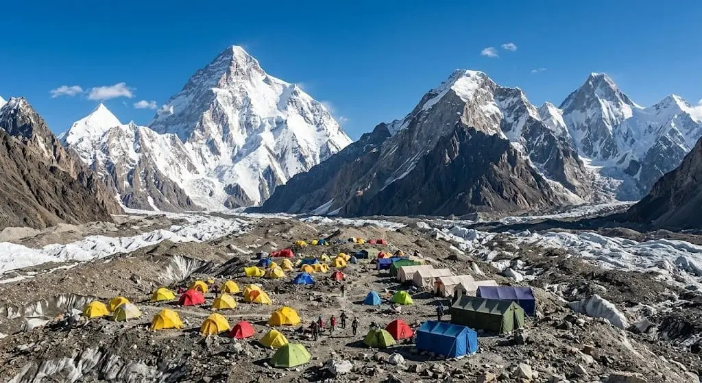
Concordia sits inside the Central Karakoram National Park at roughly 4,650 meters, reached only by trekking the Baltoro Glacier from Askole over seven to eight days each way.
What is Concordia Pakistan?
Concordia is the point where the Baltoro Glacier, flowing roughly 63 kilometers from its source near the Muztagh Tower area, merges with the Godwin-Austen Glacier descending directly from K2’s southern flank. This confluence forms a wide, flat glacial basin that functions as a natural amphitheater ringed by some of the tallest peaks on the planet. There is no settlement here — only a seasonal campsite used by trekking groups and expedition teams between June and September.
The name “Concordia” has a European origin. British mountaineer William Martin Conway applied it during his 1892 Karakoram expedition, drawing a comparison to the Concordiaplatz, a similar glacial confluence in the Bernese Oberland of the Swiss Alps. Some accounts credit an earlier reference by mountaineer John Frederic Hardy, who used “Concordia” generically for any point where multiple glaciers meet, with Conway’s usage cementing it as the proper name for this specific Karakoram site. Aleister Crowley, part of the 1902 Eckenstein-Crowley K2 expedition, also referenced the name during his attempt.
At the glacier junction, ice flowing from Godwin-Austen Glacier joins the main Baltoro trunk and bends westward toward Paiju and, eventually, the Braldu River. This hydrological role matters for mountaineering logistics: Concordia has functioned as the last major staging camp before expeditions branch off toward K2 Base Camp to the north or Broad Peak Base Camp and the Gasherbrum group to the east.
Concordia’s importance in mountaineering history predates most commercial trekking. Henry Haversham Godwin-Austen surveyed the glacier junction in 1861 for the Survey of India, and the glacier feeding K2 was later named after him. The 1909 Duke of the Abruzzi expedition, the 1954 Italian expedition that made K2’s first ascent under Ardito Desio, and the 1957 Austrian team that first climbed Broad Peak all staged their approach through Concordia. Every major K2 expedition since has passed through this same glacial junction.
Concordia earned the nickname “Throne Room of the Mountain Gods” because of the seated, amphitheater-like arrangement of peaks surrounding the basin — four 8,000-meter summits and a ring of 6,000- to 7,500-meter spires positioned as though enclosing a royal court. The name is used by trekking operators and mountaineering literature alike, and reflects the fact that no comparable single vantage point exists elsewhere in the Karakoram or Himalaya for viewing this many giants at once.
Concordia is a glacier junction, not a settlement, and its name and reputation both trace back to 19th- and early 20th-century European exploration of the Karakoram.
Where is Concordia Located?
Concordia sits inside the Karakoram Range, in the Shigar District of Gilgit-Baltistan, within the boundaries of the Central Karakoram National Park. The park protects roughly 10,000 square kilometers of high-altitude terrain, including four of the world’s fourteen 8,000-meter peaks.
The site itself is the confluence of two glaciers. The Baltoro Glacier approaches from the southwest, having flowed down from tributary ice fields near the Gasherbrum and Trango groups. The Godwin-Austen Glacier arrives from the north, descending directly from K2’s southern face. Where these two ice rivers meet, the terrain opens into a wide, relatively flat glacial plain — this open ground is Concordia.
Nearby peaks visible from this junction include K2 to the north, Broad Peak and the Gasherbrum massif to the east, Mitre Peak directly south across the Godwin-Austen Glacier, and Chogolisa and Baltoro Kangri (the Golden Throne) further southeast. Muztagh Tower and Marble Peak sit to the west along the return route toward Urdukas.
Access to Concordia runs through Skardu, the regional hub, then by jeep along the Braldu River valley to Askole or Jhola, followed by a seven- to eight-day trek across the Baltoro Glacier. No road, cable car, or helicopter service operates commercially into Concordia; the only reliable access is on foot.
Concordia — GPS reference for mapping: approximately 35°56′N latitude, 76°27′E longitude, roughly 12 km south of K2’s summit and 90 km northeast of Skardu by trekking distance.
Concordia lies inside Central Karakoram National Park, at the meeting point of the Baltoro and Godwin-Austen Glaciers, reachable only via a multi-day trek from Askole.
Why is Concordia Famous?
Concordia is famous for offering the single densest concentration of high-altitude peaks visible from any one trekking-accessible point on Earth. From this basin, trekkers can see K2 (8,611 m), Broad Peak (8,051 m), Gasherbrum I (8,080 m), and Gasherbrum II (8,035 m) — four of the world’s fourteen 8,000-meter mountains — arranged around a single glacial amphitheater.
No other trek-accessible viewpoint places four 8,000-meter peaks in one panorama. Everest Base Camp in Nepal offers views of Everest, Lhotse, and Nuptse, but not a fourth 8,000-meter summit. This concentration is what mountaineering literature and trekking operators cite when describing Concordia as the “world’s greatest mountain panorama,” a claim tied to peak density rather than any single peak’s height.
The glacier scenery adds a second layer to Concordia’s reputation. The Baltoro Glacier’s approach passes granite towers — Trango Towers, Cathedral Peak, Uli Biaho — that are among the most technical big-wall climbing objectives in the world, visible from the trekking route without any climbing required. At Concordia itself, the ice from two glaciers merges into crevassed, striated terrain framed by rock walls on all sides.
Many trekkers visit Concordia specifically to photograph K2, Broad Peak and the Gasherbrum group from a single viewpoint during sunrise.Sunrise light striking K2’s summit pyramid, the alpenglow on Broad Peak, and clear-night views of the Milky Way over the Gasherbrum group have made the site a recurring subject in mountaineering photography since the 1938 American Karakoram Expedition first documented it in widely circulated photographs.
Concordia’s expedition history reinforces its status. Every successful K2 ascent, starting with the 1954 Italian expedition, and every Broad Peak first ascent in 1957, staged through this same glacial junction, giving Concordia a documented role in Karakoram mountaineering spanning more than a century.
Concordia’s fame rests on four 8,000-meter peaks visible in one panorama, unmatched glacier scenery, and over a century of K2 and Broad Peak expedition history.
Mountains Visible from Concordia
| Peak | Height | Direction from Concordia | Visibility |
| K2 | 8,611 m (28,251 ft) | North | Visible in clear weather; often obscured by cloud buildup by midday |
| Broad Peak | 8,051 m (26,414 ft) | East-northeast | Clearly visible, closer than K2 |
| Gasherbrum I (Hidden Peak) | 8,080 m (26,509 ft) | East | Partially screened by Gasherbrum IV from some angles |
| Gasherbrum II | 8,035 m (26,362 ft) | East | Visible alongside Gasherbrum I on clear days |
| Mitre Peak | 6,025 m (19,767 ft) | South | Directly visible, iconic pyramid across Godwin-Austen Glacier |
| Chogolisa | 7,665 m (25,148 ft) | Southeast | Visible in clear conditions, further along the Vigne Glacier side |
| Marble Peak | 6,256 m (20,525 ft) | West | Visible along the Baltoro Glacier’s upper reaches |
| Baltoro Kangri (Golden Throne) | 7,312 m (23,990 ft) | South-southwest | Visible on the ridge separating Baltoro from Vigne Glacier |
K2 is frequently clouded over by mid-morning, so trekkers aiming for the clearest summit views typically position themselves at Concordia for sunrise rather than relying on afternoon visibility. Broad Peak, being closer and lower, tends to stay visible longer into the day than K2.
Concordia’s panorama includes four 8,000-meter peaks and four additional 6,000–7,500 meter summits, all visible without a side trip beyond the main campsite.
How to Reach Concordia from Islamabad
Reaching Concordia from Islamabad starts with getting to Skardu, then continuing by jeep to Askole or Jhola before beginning the seven- to eight-day trek. The full journey typically spans 12 to 18 days round trip, including acclimatization and buffer days for weather.
Step 1: Islamabad to Skardu — flight (preferred) PIA (Pakistan International Airlines) and private carriers operate flights between Islamabad and Skardu, with flight time around 1 hour and 10 minutes. These flights are weather-dependent, since the route passes close to Nanga Parbat, and cancellations of 1–3 days are common in poor visibility. Build a buffer of at least 2 extra days into your schedule around this leg.
Step 2: Islamabad to Skardu — road option The Karakoram Highway route via Chilas covers roughly 480–500 km and takes 18–24 hours by road, usually split across 2 days with an overnight stop in Chilas or Gilgit. This route is a reliable backup when flights are grounded, and it also passes Nanga Parbat viewpoints along the way.
Step 3: Skardu to Askole or Jhola — jeep From Skardu, a 4×4 jeep convoy follows the Shigar Valley and the Braldu River toward Askole, a drive of roughly 6–7 hours over rough, partly unpaved roads. Since a 2021 road extension, many operators now drive groups directly to Jhola camp, cutting one to two days off the walking itinerary that previously required an overnight stay in Askole itself.
Step 4: Trek stages from Jhola/Askole to Concordia The walking route runs through a sequence of established camps: Jhola, Paiju (with a rest day for glacier acclimatization), Khoburtse, Urdukas, Goro II, and finally Concordia. Each stage covers 6 to 21 kilometers depending on terrain, with daily walking times of 4 to 8 hours.
Step 5: Estimated total travel time
- Islamabad to Skardu: 1 day (flight) or 2 days (road)
- Skardu to Jhola/Askole: 1 day by jeep
- Jhola/Askole to Concordia: 7–8 trekking days, including one rest day
- Return trek plus travel back to Islamabad: 6–8 days
A realistic round-trip window from Islamabad back to Islamabad, Concordia-only (without continuing to K2 Base Camp or crossing Gondogoro La), runs 15 to 18 days including weather buffers.
Reaching Concordia from Islamabad requires a flight or road transfer to Skardu, a jeep ride to Askole or Jhola, then seven to eight trekking days across the Baltoro Glacier.
Baltoro Glacier Trek Route
The Baltoro Glacier trek to Concordia runs through six primary camps — Askole/Jhola, Paiju, Khoburtse, Urdukas, Goro II, and Concordia — covering roughly 80–95 kilometers one way over seven to eight trekking days.
Day 1: Askole/Jhola to Paiju Distance: 20–21 km. Elevation: 3,000 m (Askole) to 3,450 m (Paiju). Walking time: 6–7 hours. The trail follows the Braldu River valley, crossing the Biafo Glacier’s outwash and passing the first views of the Paiju rock pinnacles. Camp is set at Paiju, a grassy site with fresh streams, used as a rest and acclimatization stop before entering the glacier proper.
Day 2: Rest day at Paiju No net distance gained. This buffer day allows bodies to adjust before the trail moves onto glacier terrain for the remainder of the route. Most itineraries treat this as mandatory rather than optional given the altitude gain that follows.
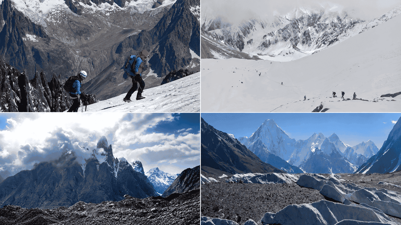
Day 3: Paiju to Khoburtse Distance: 15–20 km. Elevation: 3,450 m to roughly 3,795–3,850 m. Walking time: 6–8 hours. This stage marks the first full day on the Baltoro Glacier itself, crossing moraine, rock debris, and exposed ice. Trekking poles and sturdy boots matter here more than on the approach walk.
Day 4: Khoburtse to Urdukas Distance: 6–7 km. Elevation: gain of roughly 250–400 m to 4,050–4,130 m. Walking time: 3–5 hours. Despite the short distance, this stage climbs steeply to Urdukas, the last grassy campsite on the route and a location known for wide views of Trango Towers, Uli Biaho, and Cathedral Peak.
Day 5: Urdukas to Goro II Distance: 9–14 km. Elevation: gain to roughly 4,350–4,380 m. Walking time: 5–7 hours. This stage crosses onto the icy heart of the glacier, passing Goro I before reaching Goro II camp, where trekkers get their first full view of Masherbrum (7,821 m) to the south.
Day 6: Goro II to Concordia Distance: 9–12 km. Elevation: gain to 4,600–4,691 m. Walking time: 5–7 hours. K2 remains hidden behind ridgelines until the final approach into the Concordia basin, at which point the summit appears directly ahead, framed by Broad Peak and the Gasherbrum group.
Day 7 (optional): Concordia to K2 Base Camp and back Distance: 20–22 km round trip. Elevation: to 5,150 m at K2 Base Camp. Walking time: 8–11 hours. This is a long single day trip from Concordia and back, sometimes combined with a shorter visit to Broad Peak Base Camp and the Gilkey Memorial instead.
Return route The return trek reverses the same six camps — Goro II, Urdukas, Khoburtse, Paiju, Jhola — typically completed in 4 to 6 days, since descent and acclimatization needs are lower than on the ascent.
| Stage | Distance | Elevation | Walking Time | Camp |
| Askole/Jhola → Paiju | 20–21 km | 3,000 → 3,450 m | 6–7 hrs | Paiju |
| Rest day | — | 3,450 m | — | Paiju |
| Paiju → Khoburtse | 15–20 km | 3,450 → 3,795 m | 6–8 hrs | Khoburtse |
| Khoburtse → Urdukas | 6–7 km | 3,795 → 4,130 m | 3–5 hrs | Urdukas |
| Urdukas → Goro II | 9–14 km | 4,130 → 4,380 m | 5–7 hrs | Goro II |
| Goro II → Concordia | 9–12 km | 4,380 → 4,691 m | 5–7 hrs | Concordia |
Camp locations along the Baltoro Glacier trek to Concordia are fixed by tradition and water access, and virtually every operator uses this same six-stage sequence.
The Baltoro Glacier trek covers roughly 80–95 km one way across six established camps, gaining nearly 1,700 meters of elevation over seven to eight days.
Concordia Trek Difficulty
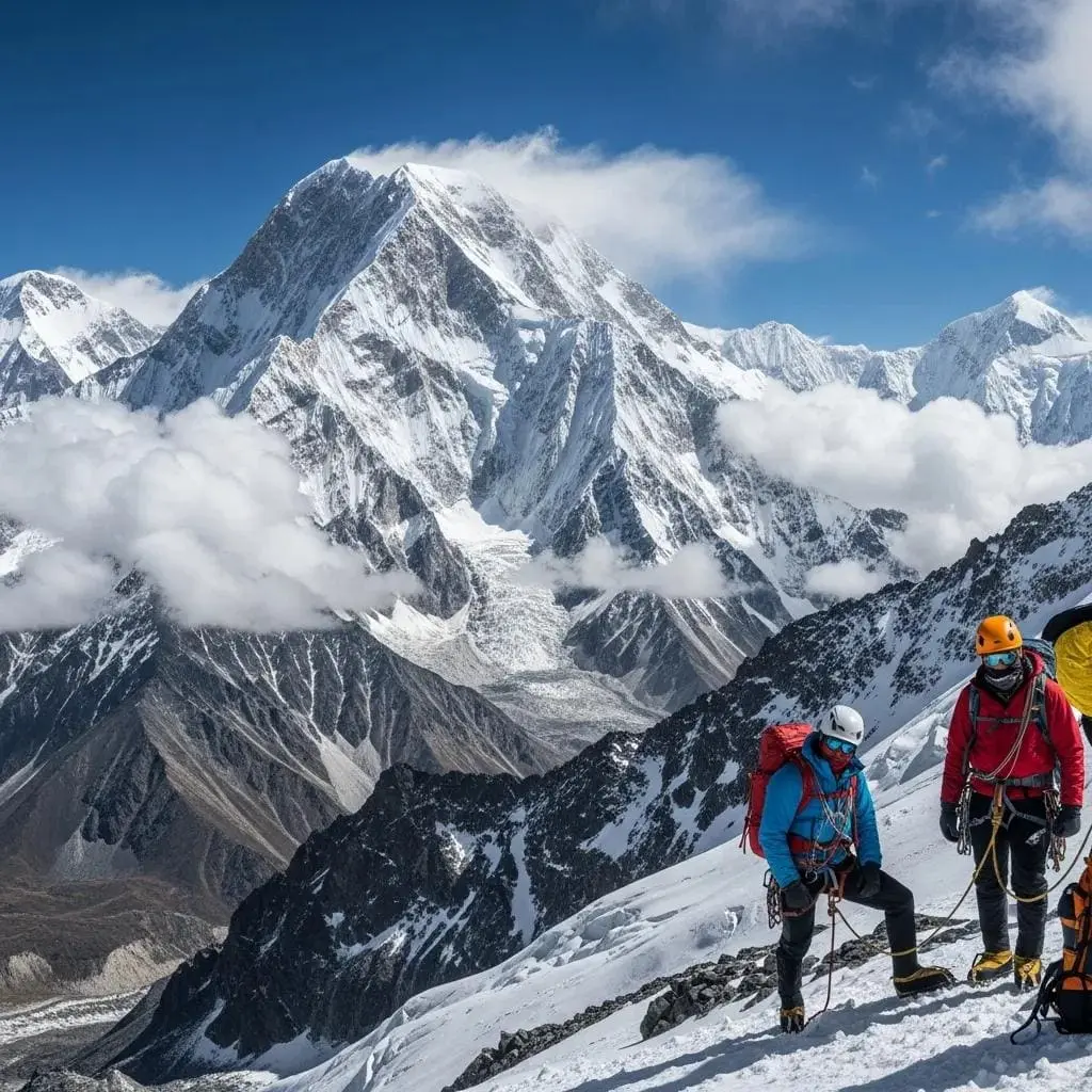
The Concordia trek is rated strenuous — it demands strong cardiovascular fitness and multi-day stamina, but it does not require technical climbing skills or rope work.
Fitness requirements center on sustained daily walking of 5 to 8 hours over multiple consecutive days, often on uneven moraine and glacier ice rather than a maintained trail. Prior multi-day trekking experience at altitude is strongly recommended before attempting this route; it is not a suitable first high-altitude trek for someone with no backcountry hiking background.
Glacier walking makes up a significant portion of the route from Khoburtse onward. The Baltoro Glacier’s surface includes loose rock debris, meltwater streams, ice ridges, and occasional crevasses near tributary junctions. A guide familiar with the current glacier surface conditions is essential, since the ice shifts season to season and old route markers can become unreliable.
River crossings occur mainly in the lower valley before the glacier begins, at points like the Dumordo River near Jhola, where seasonal snowmelt can raise water levels significantly by afternoon. Crossings are usually done via cable bridges or, in some spots, temporary wooden structures rebuilt each season.
Altitude is the dominant risk factor. Concordia sits above 4,600 meters, and the trek spends multiple consecutive nights above 3,450 meters with limited opportunity for full descent between stages. Acute Mountain Sickness is a realistic concern for any trekker on this route, regardless of general fitness level.
This is not a trek suitable for everyone. Pre-existing cardiac or respiratory conditions, lack of high-altitude experience, and unwillingness to turn back if symptoms worsen all significantly raise personal risk on this route. Trekkers should have completed at least one prior trek above 3,500 meters before attempting Concordia.
Risks beyond altitude include sudden weather changes, rockfall on exposed sections near Paiju and Khoburtse, and the remoteness of the route — the nearest hospital-level care is in Skardu, several trekking days away from Concordia itself.
The Concordia trek is strenuous and non-technical, but altitude, glacier terrain, and remoteness mean it is not appropriate for trekkers without prior high-altitude experience.
Altitude and Acclimatization
Acute Mountain Sickness (AMS) is a genuine risk on the Concordia trek because the route holds trekkers above 3,450 meters for six or more consecutive nights, climbing to 4,691 meters at Concordia itself.
Prevention relies on a gradual ascent profile and built-in rest days. Most itineraries schedule a mandatory rest day at Paiju (3,450 m) before the glacier sections begin, allowing the body to start adjusting before elevation gain accelerates. The “climb high, sleep low” principle applies where terrain allows, though the fixed camp system on this route limits flexibility compared to treks with more campsite options.
Because camps from Paiju to Concordia have dry mountain air and long glacier walking days, most guides recommend drinking 3–4 litres of treated water daily, since dry mountain air and increased respiration rate both accelerate fluid loss. Guides typically recommend 3 to 4 liters of water per day, with all drinking water treated by filtration, purification tablets, or boiling, since natural water sources on the glacier carry sediment and potential contamination from upstream camps.
Acclimatization schedule: the standard itinerary gains roughly 1,650 meters of net elevation over seven trekking days from Askole/Jhola to Concordia, averaging under 250 meters of net gain per day, with the Paiju rest day acting as the main buffer point. Trekkers arriving from low elevations should also budget one or two nights in Skardu (2,228 m) before starting the trek.
Symptoms of AMS include headache, nausea, dizziness, loss of appetite, and disrupted sleep. More severe symptoms — confusion, ataxia (loss of coordination), or fluid-related coughing — indicate possible High Altitude Cerebral or Pulmonary Edema and require immediate descent, not continued ascent or rest in place.
Emergency evacuation options on this route are limited and slow. Helicopter rescue is possible from certain points along the Baltoro Glacier in clear weather, but it is expensive, not guaranteed, and dependent on operator arrangements and confirmed insurance coverage before departure. Ground evacuation on foot or by porter-assisted carry can take multiple days from Concordia back to the nearest road access at Askole.
Every trekker should carry comprehensive travel insurance that explicitly covers high-altitude helicopter evacuation up to at least 6,000 meters, and should confirm this coverage in writing before departure, not assume it is included by default.
Acclimatization on the Concordia trek depends on a gradual daily ascent, a mandatory rest day at Paiju, and the discipline to descend immediately if AMS symptoms appear.
Best Time to Visit Concordia
The best time to visit Concordia is late June through early September, when snow cover on the trail is at its lowest and river crossings are most manageable.
| Month | Snow | Temperature (day/night at Concordia) | Trail Condition | Visibility |
| May | Heavy on upper glacier | 5°C / -10°C | Difficult, snow-covered upper stages | Variable, frequent cloud |
| June | Moderate, clearing | 8°C / -8°C | Improving, some snow patches remain | Good, increasing through month |
| July | Minimal | 12°C / -5°C | Best condition of the season | Best, most stable weather |
| August | Minimal | 12°C / -5°C | Best condition, some monsoon-linked cloud | Good, occasional afternoon cloud |
| September | Increasing late-month | 8°C / -8°C | Good early, deteriorating late | Good early, declining late |
| October | Heavy, route often closes | -2°C / -18°C | Poor, most operators stop trips | Poor, early winter storms |
Advantages of a July–August trek: most stable weather window of the year, lowest snow accumulation on glacier stages, longest daylight hours for trekking, and the highest likelihood of a clear K2 summit view at sunrise.
Disadvantages of peak season: busiest camps along the route, highest jeep and porter demand (book 2–3 months ahead), and occasional monsoon-linked cloud buildup by afternoon, especially in August.
Advantages of a June or early-September trek: noticeably fewer trekking groups on the trail and lower camp congestion at Paiju and Urdukas.
Disadvantages of shoulder-season timing: greater snow on the upper glacier stages in June, and a real risk of early winter weather cutting a September trip short if the trek is scheduled after the first week of the month.
The best time to visit Concordia is July or August, when snow cover is lowest, weather is most stable, and visibility for K2 and Broad Peak is at its best.
Concordia Trek Cost
A guided Concordia trek from Islamabad typically costs between USD 1,700 and 2,500 per person for a mid-range group package, with private or fully customized expeditions running higher.
| Item | Estimated Cost |
| CKNP Trekking Fee | ~USD 150 per person (per month, restricted area) |
| CKNP Environment/Waste Management Fee | ~USD 190–200 per person |
| Guide | USD 30–50 per day |
| Porter (per porter, ~25 kg load) | USD 15–25 per day |
| Cook | USD 25–35 per day |
| Jeep (Skardu ↔ Askole/Jhola, round trip, shared) | USD 250–400 per jeep |
| Food on trek | USD 15–25 per day per person |
| Camping (tents, mess tent, kitchen setup) | Usually bundled into package cost |
| Equipment rental (sleeping bag, poles, crampons) | USD 5–15 per item, per trek |
Budget group trek (12–18 days, shared costs across a group): roughly USD 1,700–2,500 per person, typically including transfers within Pakistan, permits, liaison officer, guide, porters, cook, tents, and trekking meals. International flights, travel insurance, tips, and personal gear are usually extra.
Private or small-group expedition: costs rise to USD 3,000–5,000+ per person, reflecting a lower porter-to-trekker ratio, dedicated guide attention, and often additional rest or buffer days built into the schedule.
Additional costs to budget separately: international flights (USD 800–1,500 depending on origin), travel insurance with high-altitude evacuation coverage (USD 150–300), staff tips (USD 150–300 per trekker for the full crew), and personal equipment purchases if not renting locally.
The Concordia trek costs roughly USD 1,700–2,500 per person for a standard guided group package, with permits, guide, porter, and food fees layered on top of jeep transport and camping.
Permits and Trekking Regulations
Foreign trekkers need a restricted-area trekking permit to enter the Baltoro Glacier and Concordia zone, which falls inside Central Karakoram National Park and Pakistan’s Gilgit-Baltistan restricted trekking zone.
Foreign permits: individual foreign trekkers cannot apply directly for this permit. Applications must go through a registered tour operator licensed with Pakistan’s Directorate of Tourist Services, who submits the paperwork to the Gilgit-Baltistan Council Secretariat on the trekker’s behalf.
Local regulations: the restricted zone begins at Askole and covers the full Baltoro-Concordia-Gondogoro corridor. A Liaison Officer requirement applies to larger expedition groups on some routes, though standard commercial Concordia treks are typically processed as group trekking permits rather than full expedition permits.
Passport requirements: trekkers need a passport valid for at least six months beyond the planned travel dates, along with passport-sized photos for permit processing, which operators typically request several weeks in advance.
Visa: most foreign nationals require a Pakistan tourist visa obtained in advance or, for some nationalities, an e-visa. Processing times vary by nationality, so this should be arranged well before booking non-refundable flights.
Licensed operator: hiring a Directorate of Tourist Services-registered operator is not optional for this route — it is the only legal channel for both the trekking permit and the CKNP environmental fee. Independent, unguided foreign trekking into this zone is not permitted under current regulations.
Insurance: operators generally require proof of travel insurance with high-altitude rescue coverage before confirming a booking, and this should be arranged separately from any coverage the operator itself carries for staff.
Permit fees and exact regulations have changed multiple times in recent years, including a significant restructuring of Pakistan’s mountaineering royalty system between 2024 and 2026. Confirm current fee structures directly with a licensed operator or the Gilgit-Baltistan Council Secretariat before finalizing a budget, rather than relying on older published figures.
Foreign trekkers must book through a licensed Pakistani operator to obtain restricted-area permits, CKNP fees, and visa documentation for the Concordia trek.
Solo Trek vs Guided Trek
| Factor | Solo Trek | Guided Trek |
| Pros | Full control over pace, no group compromise | Legally required permits arranged, local knowledge, established camp logistics |
| Cons | Not legally permitted for foreign trekkers in this restricted zone | Fixed group schedule, less flexibility on daily pace |
| Safety | No local backup, higher risk in an AMS or injury emergency | Guide monitors symptoms, porter support, established evacuation contacts |
| Cost | Not applicable — independent foreign entry is not authorized | USD 1,700–5,000+ depending on package type |
| Experience | Not available to foreign nationals under current rules | Structured route knowledge, cultural context from Balti guides and porters |
| Recommendation | Not viable for foreign trekkers | Required and advisable for this specific route |
Independent, unguided trekking by foreign nationals into the Baltoro-Concordia restricted zone is not permitted under current Pakistani regulations, regardless of individual experience level. A licensed guide and operator are mandatory, which makes the “solo vs guided” comparison largely a question of which guided package tier — small private group or larger scheduled departure — rather than whether to hire a guide at all.
Pakistani nationals face different rules and may have more flexibility for independent travel in open zones, but the Baltoro Glacier corridor to Concordia falls under restricted-area status for all nationalities attempting the full route to K2 Base Camp or beyond.
For foreign trekkers, the practical choice is between a scheduled group departure (lower cost, fixed dates, shared porters) and a private custom trek (higher cost, flexible dates, dedicated guide and porter team). A licensed guided trek is required by law for this route.
Essential Packing List
Clothing
- Moisture-wicking base layers (synthetic or merino wool)
- Insulated mid-layer (fleece or lightweight down jacket)
- Heavyweight down jacket rated for temperatures below -10°C
- Waterproof, windproof outer shell (jacket and pants)
- Trekking trousers, quick-dry
- Thermal base layer for sleeping and camp use
- Warm hat, sun hat with wide brim, buff or neck gaiter
- Insulated gloves plus a thin liner glove pair
- Wool or synthetic hiking socks (4–5 pairs), plus thermal sleep socks
Sleeping Bag
- Four-season sleeping bag rated to at least -15°C (5°F), given Concordia’s overnight lows
- Sleeping bag liner for added warmth and hygiene
Boots
- Broken-in, waterproof trekking boots with ankle support, suitable for glacier moraine
- Camp shoes or sandals for evenings at lower camps
Trekking Poles
- Adjustable trekking poles, essential for glacier moraine and river-adjacent sections
Medical Kit
- Personal first-aid kit: blister treatment, antiseptic, bandages, adhesive tape
- Diamox or equivalent AMS medication (consult a doctor before the trip)
- Personal prescription medications in original packaging
- Rehydration salts
- Basic pain relief and anti-nausea medication
Water Purification
- Water purification tablets or a filtration bottle/pump
- At least two 1-liter bottles or a hydration bladder, sized for 3–4 liters daily capacity
Electronics
- Headlamp with spare batteries
- Camera with spare batteries (cold drains batteries faster)
- Phone with offline maps downloaded before losing signal near Askole
Power Bank
- A 20,000 mAh or larger power bank, since no reliable charging exists between Askole and Skardu on return
Snacks
- High-calorie trail snacks: nuts, dried fruit, energy bars, electrolyte powder
- Personal comfort snacks, since trek-provided food is often repetitive over 12+ days
Concordia’s packing priorities are a sub-zero-rated sleeping bag, broken-in boots for glacier moraine, and a reliable power bank, since electricity and shops disappear after Askole.
Photography Tips
- Sunrise at Concordia: the clearest K2 views typically occur in the first hour after sunrise, before daytime cloud buildup obscures the summit — position for shooting the night before rather than waiting until first light.
- Sunset light on Broad Peak and Gasherbrum group: the eastern peaks catch alpenglow after the sun drops behind the western ridgeline, often producing stronger color than the sunrise side.
- Milky Way photography: Concordia’s lack of light pollution and typically dry summer air make it a strong location for night-sky shots; a tripod and a lens with an aperture of f/2.8 or wider are recommended for this.
- Lens recommendations: a wide-angle lens (16–35mm equivalent) covers the full glacier panorama, while a mid-telephoto (70–200mm equivalent) isolates individual summits like K2’s pyramid or Mitre Peak’s spire.
- Drone regulations: commercial and recreational drone use in Gilgit-Baltistan requires prior permission from Pakistani civil aviation and, within Central Karakoram National Park, additional clearance from park authorities — confirm current rules with your operator before packing one, since enforcement and requirements have shifted in recent years.
- Best viewpoints: the main Concordia campsite offers the widest panorama; a short climb onto the moraine ridge above camp improves the angle on K2 by removing foreground ice clutter; Goro II camp, the stage before Concordia, gives an earlier first look at Masherbrum for those wanting more time to compose long-lens shots.
Concordia rewards early starts, wide-angle panorama shots at the main camp, and long-lens work from the moraine ridge above it for isolated summit shots.
Safety Tips
- Weather along the Baltoro Glacier can change within hours, so trekkers should monitor forecasts in Skardu and include at least two weather-buffer days before returning to Islamabad ; check forecasts in Skardu before departure and build 1–2 buffer days into the itinerary for delayed jeep or flight legs.
- Glacier hazards: the Baltoro Glacier’s surface includes hidden crevasses near tributary junctions, particularly around Concordia and Goro II — stay on the route your guide sets and avoid wandering off the established path, even for photos.
- Rescue: helicopter evacuation from points along the Baltoro Glacier is possible in clear weather but is not guaranteed and can take hours to arrange — confirm your operator’s heli-rescue deposit arrangement before departure.
- Communications: cell coverage disappears past Askole for most networks; a satellite messenger device (inReach or similar) provides a safety margin your guide’s radio may not fully replace.
- Insurance: carry travel insurance with explicit high-altitude helicopter evacuation coverage to at least 6,000 meters, and keep a printed copy of the policy with your permit documents.
- Emergency contacts: save the phone numbers of your operator’s Skardu office, the nearest hospital in Skardu, and your country’s nearest consulate in Islamabad before departure, since local staff may need these relayed quickly in an emergency.
Weather delays, glacier crevasse hazards, and limited rescue options make satellite communication and verified evacuation insurance the two most important safety preparations for this trek.
Frequently Asked Questions
Is Concordia the same as K2 Base Camp? No. Concordia is a separate glacial junction roughly 20–22 kilometers round trip from K2 Base Camp itself. Many itineraries visit both, using Concordia as the camp from which trekkers make a day trip to K2 Base Camp and back, but they are distinct locations at different elevations.
How high is Concordia? Concordia sits at approximately 4,600 to 4,691 meters (15,090–15,390 feet) above sea level, at the confluence of the Baltoro and Godwin-Austen Glaciers.
How long does it take to trek to Concordia? From Askole or Jhola, the one-way trek to Concordia takes seven to eight days, including one mandatory rest day at Paiju for acclimatization. A full round trip, including travel to and from Islamabad, typically runs 15 to 18 days.
Do I need a guide to trek to Concordia? Yes. Foreign nationals are legally required to trek this restricted zone with a licensed Pakistani operator, guide, and the appropriate CKNP and trekking permits. Independent foreign trekking into this corridor is not permitted.
What is the best month to trek to Concordia? July and August offer the most stable weather, lowest snow cover on the glacier stages, and the best odds of clear K2 visibility. June and early September are viable shoulder-season options with fewer crowds but higher weather risk.
Can beginners trek to Concordia? The trek does not require technical climbing skills, but it does require solid cardiovascular fitness and prior experience with multi-day trekking at altitude. It is not recommended as a first high-altitude trek for someone with no backcountry hiking background.
How much does the Concordia trek cost? A standard guided group package runs roughly USD 1,700–2,500 per person, covering permits, guide, porters, cook, camping, and trek meals. International flights, insurance, tips, and personal equipment are typically extra. Private or small-group treks cost more.
What permits do I need? Foreign trekkers need a Pakistan tourist visa, a restricted-area trekking permit, and CKNP environmental and trekking fees, all processed through a licensed tour operator. Individual foreign applicants cannot apply directly to Pakistani authorities for these permits.
Is altitude sickness a real risk on this trek? Yes. Concordia sits above 4,600 meters, and the route holds trekkers above 3,450 meters for multiple consecutive nights. AMS symptoms including headache, nausea, and dizziness are common, and immediate descent is the correct response if symptoms worsen.
Will I definitely see K2 from Concordia? Not guaranteed. K2 is frequently visible at sunrise but often clouds over by mid-morning. Weather in the Karakoram is unpredictable enough that some trekkers spend a rest day at Concordia specifically to improve their odds of a clear view.
Is there phone signal at Concordia? No reliable cell coverage exists past Askole for most networks. A satellite messenger device is the more dependable option for emergency communication along the route.
Can I combine Concordia with the Gondogoro La crossing? Yes. Many operators offer an extended itinerary that continues from Concordia over the Gondogoro La pass to Hushe village, adding roughly 4–5 days and requiring additional high-altitude pass experience compared to a standard there-and-back Concordia trek.
Do I need travel insurance specifically for high-altitude evacuation? Yes. Standard travel insurance policies often exclude high-altitude trekking or cap evacuation coverage below the elevations reached on this trek. Confirm your policy explicitly covers helicopter evacuation to at least 6,000 meters before departure.
What is the closest hospital to Concordia? Skardu has the nearest hospital-level medical care, several trekking days away from Concordia by foot. This distance is the primary reason guides emphasize early symptom recognition and immediate descent over waiting to see if AMS symptoms improve.
Are there toilets or shower facilities on the trek? Camps use portable or pit-style toilet setups maintained by trekking crews; there are no shower facilities along the route past Paiju, and most trekkers rely on wet wipes for personal hygiene for the remainder of the trip.