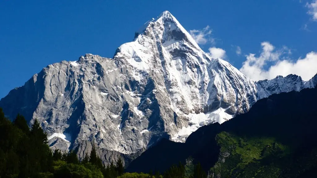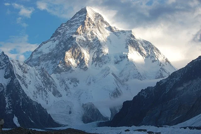
Lead: What This Guide Gives You (Fast)
K2 sits at the edge of what most travelers call “the impossible” — a raw, knife-edged peak that demands respect. Whether you’re an elite mountaineer, a high-altitude trekker, or a curious traveler wanting to witness the world’s second-highest mountain without climbing it, this guide gives you everything: routes, summit risks, weather windows, trek logistics, and ethical tips. It cuts through the hype with clear, practical advice, including a realistic mini-itinerary and a concise FAQ for fast answers.
K2: Quick Facts at a Glance
- Height: 8,611 m (28,251 ft)
- Location: Karakoram Range — on the Pakistan–China border (Gilgit-Baltistan / Xinjiang)
- Nickname: “The Savage Mountain” — more technically dangerous than Everest
- First Ascent: 1954 by an Italian expedition
- Known for: High fatality rate, extreme weather, and legendary technical challenges
- Primary Access: From Shigar Valley, Skardu, Pakistan
- Standard Climbing Route: Abruzzi Spur (features House’s Chimney, Black Pyramid, the Bottleneck)
Why K2 Is Legendary: Technical Difficulty & Fatal Risks

K2’s reputation is well earned. Unlike Everest, it offers no easy route. The climb is steep, exposed, and technical from base to summit. The Bottleneck, a narrow couloir under hanging seracs near 8,200 m, is one of the most dangerous features in high-altitude climbing — multiple fatal accidents have occurred here. Rapid weather changes and short summit windows increase the risk.
Key takeaway: K2 is harder and more dangerous than most 8,000-meter peaks. Even elite climbers approach it with extreme caution.
How Dangerous Is K2? Stats & Historical Context
- Historic fatality ratio: In earlier decades, roughly 1 death for every 4 summits
- Current estimate: ~800 successful summits and 90–100 deaths total
- Deadliest years: 1986, 1995, 2008 — each saw multiple climber fatalities in a single season
- Recent trend: More summits due to improved gear and forecasting, but fatal risks remain high
For non-climbers: These risks don’t apply to you directly — trekking to base camp or Concordia is a non-technical adventure, but you’ll still be in remote high-altitude conditions where weather can change quickly.
Where Is K2 and How Do You Reach It?
Closest Access Point:
Skardu (Gilgit-Baltistan) — a remote town that serves as the launchpad for K2 expeditions and treks.
Step-by-Step Travel Route (Non-Climbers and Climbers)
- Fly to Islamabad (ISB)
- Domestic flight or long drive to Skardu
- Flights: 1 hour (weather-dependent, often delayed)
- Drive: 20+ hours via the Karakoram Highway
- From Skardu to Askole or Hushe (by jeep)
- Trek to Concordia (8–12 days one way) or K2 Base Camp
- Trekking routes vary but commonly go via Baltoro Glacier
- Concordia is where you can see K2, Broad Peak, and other giants
Permits
- Climbers: Need special high-altitude expedition permits, liaison officer, and environmental fees
- Trekkers: Require domestic travel permits and national park entry fees — arrange via local operator
Best Time to Visit: Seasons & Weather
- Trekking season: June–September
- July–August is the warmest, but with a higher chance of storms
- May or September can offer more stable skies, but colder conditions
- Climbing season: Late June to early August (short summit window)
- Winter climbing: Extremely dangerous — the first winter ascent only occurred in February 2021 by a Nepalese team
Tourist tip: Build 2–3 buffer days into your trip for flight delays or bad weather on the trail.
K2 Routes (Climbers Only)
Most Common:
- Abruzzi Spur (SE Ridge)
- Used by most commercial teams
- Includes House’s Chimney, Black Pyramid, Bottleneck
Other Routes:
- Cesen / Polish Route
- North Ridge / East Face: Rarely attempted, far more dangerous
Climbing Cost Estimate:
- Commercial Expeditions: $30,000–$70,000+
- Includes gear, permits, Sherpa/porter support, oxygen (optional), liaison, food, insurance, logistics
What Can Non-Climbers Do Around K2?
Top Experiences Without Climbing:
- Trek to Concordia — glacier crossroads with panoramic views of K2, Broad Peak, and Gasherbrum
- Broad Peak Base Camp — a safe vantage point with a direct line of sight to K2
- Cultural stays in Skardu, Hushe, or Hunza — engage with Balti communities, try local food, and explore markets
- Photography treks — capture dawn light, massive glaciers, and towering granite faces
Local Tip: Respect the porter culture — pay fairly, tip generously, and never underload your staff. Many local tragedies stem from exploitation and lack of protection.
Warnings & Ethics
- Summiting K2 is for elite climbers only. Don’t confuse proximity with preparedness.
- Use licensed, reputable operators — avoid unregistered outfits or underpaid guides
- Don’t sensationalize deaths for social media clicks — this mountain carries real human cost
- Support ethical tourism: Hire local, pay fair, follow cultural norms, and leave no trace
Sample 12–15 Day Itinerary (Non-Climbers)
Day 0–1: Arrive Islamabad → Flight or drive to Skardu
Day 2: Rest day in Skardu, gear check, permit finalization
Day 3–4: Jeep ride to Askole / Hushe (depends on route)
Day 5–12: Trek to Concordia and return
- Camps set with a local operator
- Include 2–3 acclimatization or rest days
Day 13–15: Return to Skardu → Optional Hunza extension → Fly home
Note: Fit trekkers could complete the trek in 10 days, but weather delays are common — plan buffer days and altitude meds.
FAQs: Fast Answers to Common Questions
- Where is K2 located?
Karakoram Range — on the Pakistan–China border, mostly accessed from Pakistan. - How high is K2?
8,611 meters (28,251 feet). - How dangerous is K2?
One of the deadliest eight-thousanders — highly technical and storm-prone. - Has K2 been summited in winter?
Yes — the first successful winter summit was in February 2021 by a Nepali team. - How many people have summited K2?
Approximately 800 climbers (as of the most recent data). - How many people have died on K2?
Around 90–100 fatalities in total; the death rate is among the highest. - Is K2 more dangerous than Everest?
Yes — steeper terrain, fewer rescue options, and more unpredictable weather. - Can tourists see K2 without climbing?
Yes — Concordia trek offers stunning views without technical climbing. - What permits are required?
Expedition permits for climbers, trekking, and park permits for others. - How long is the trek to Concordia?
8–12 days one way, depending on route, weather, and acclimatization. - Do I need a guide?
Strongly recommended — for safety, logistics, and cultural translation. - Are helicopter rescues available?
Yes, but limited and weather-dependent; costly and not guaranteed. - Can I do a short trip to Skardu?
Yes — Skardu offers short hikes, cultural sites, and lake excursions. - Is solo travel safe?
Generally, yes, with a local operator; the region is remote but hospitable. - What to pack for a trek?
Layers, rainproof gear, headlamp, meds, permit copies — ask your operator for a full list. - What vaccinations or health prep is needed?
Standard travel vaccines + high-altitude readiness plan. - Is the region accessible year-round?
No — winter access is nearly impossible; monsoon affects late summer travel. - Where can I find the most up-to-date climbing statistics?
Use dispatches from climbing teams, Pakistani authorities, or reliable mountaineering journals.
