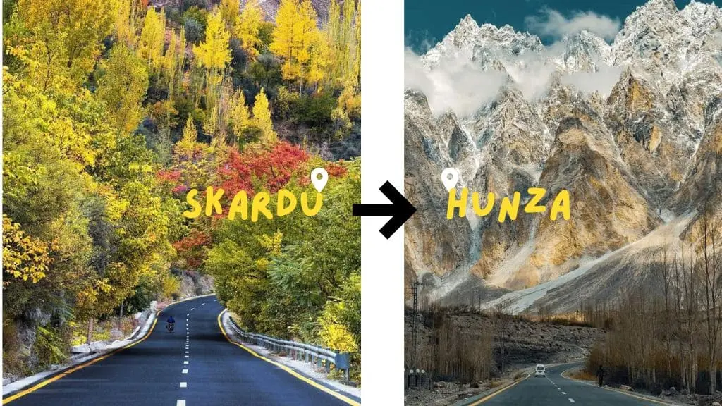
The ultimate road trip guide mapping the scenic distance and route from Skardu to Hunza Valley.
The driving distance from Skardu to Hunza Valley is 289 km via the Gilgit-Skardu Road (S-1) and Karakoram Highway (N-35), taking approximately 5 to 6 hours of moving time (7 to 8 hours for a typical travel day with scenic stops). An alternative summer-only route via the Deosai Plains and Astore spans 333 km and takes around 8 to 9 hours by 4×4.
Factor
Route 1 — KKH & Gilgit-Skardu Road
Route 2 — Deosai Plains & Astore
Distance
289 km
333 km
Approx. travel time
5–6 hours (moving) / 7–8 hours (travel day)
8–9 hours
Accessibility
Faster, paved, open year-round
Remote, unpaved, summer-only
Best season
Year-round (subject to local weather)
June to September
Vehicle
Standard road vehicles
4×4 recommended
Main route
Skardu → Alam Bridge → Gilgit → Hunza
Skardu → Deosai → Astore → KKH → Hunza
Best for
Fast, direct travel with easy road access
Adventure, high-altitude landscapes
Skardu to Hunza Distance and Travel Time
Why Published Distances Differ
Search this route and you will find anything from 270 km to 400 km. The figures differ because different pages measure different journeys. Google Maps routes it at 283 km from Skardu town. Ending at Karimabad or Attabad instead of Aliabad adds another 10 to 25 km. Anything above 330 km is measuring the Deosai route, not this one. We measure Skardu city to Aliabad: 289 km.
Moving Time vs. a Real Travel Day
Moving time: About 5 hours 20 minutes
Typical travel day: 7 to 8 hours
With delays: 9 hours or more
The gap between the map estimate and a real travel day is not bad driving. It is fuel stops, a meal in Gilgit, checkpost registration, and single-lane stretches where you stop to let oncoming traffic through. Plan to leave Skardu early enough to arrive in Hunza before dark.
On the main route, no. The S-1 and the Karakoram Highway are paved the whole way, and a well-maintained sedan handles the drive comfortably. What matters more than drive type is condition: good tyres, working brakes, and a spare, because service stops between Skardu and Gilgit are limited.
The Deosai route is a different journey. It is an unpaved high-altitude track with river crossings, and it needs a 4×4 and a driver who has done it before. If you are choosing between the two, that difference matters more than the extra 44 km.
Road Conditions and What Slows You Down
Season
Main route (S-1 + N-35)
Effect on travel time
Spring (Mar–May)
Open. Melt season raises rockfall and landslide risk
Minor delays possible; allow extra travel time
Summer (Jun–Sep)
Open, best road conditions. Deosai route also open
Closest to the 7–8 hour estimate
Autumn (Oct–Nov)
Open, generally settled weather
Closest to the 7–8 hour estimate
Winter (Dec–Feb)
Open. Snow and ice on the S-1; The main route stays open year-round, though winter adds extra travel time due to snow and ice.
Adds hours; occasional short waits for road clearance
Note on Delays: Disruption on this road is usually short rather than seasonal. For example, in January 2026, a magnitude 5.6 earthquake near Barishal triggered landslides that temporarily blocked sections of the Karakoram Highway. Heavy clearance machinery was deployed, and the highway was quickly reopened. That is the normal pattern to plan for — delays of a few hours, occasionally a day, rather than full route closures.
Route Options: Skardu to Hunza
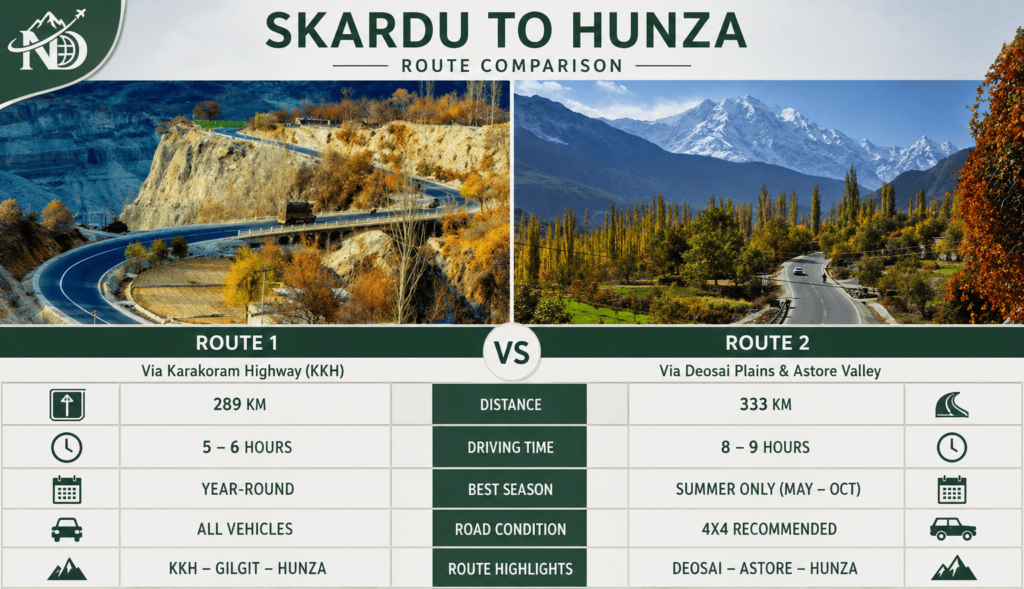
Skardu to Hunza route comparison: 289 km via the Karakoram Highway versus 333 km via Deosai Plains and Astore.
There are two main ways to travel between Skardu and Hunza Valley. The primary option via the Gilgit-Skardu Road (S-1) and Karakoram Highway (N-35) is paved, faster, and open year-round. The alternative option via the Deosai Plains and Astore offers a scenic, high-altitude summer adventure requiring a 4×4 vehicle.
Route 1: Skardu to Hunza via KKH & Gilgit-Skardu Road
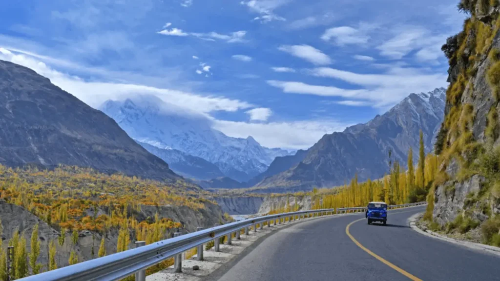
Cruising down the iconic Karakoram Highway with spectacular views of the Hunza peaks.
Skardu to Alam Bridge (S-1): The newly upgraded Gilgit-Skardu Highway offers smooth, two-lane asphalt through the Indus River gorge. Keep an eye out for minor rockfall zones near Astak during rain or rapid snowmelt.
Alam Bridge to Jaglot & Gilgit: At Alam Bridge, you meet the Karakoram Highway junction. You can bypass Gilgit proper if traveling directly to Hunza, stopping briefly at Jaglot where the Karakoram, Himalaya, and Hindu Kush mountain ranges meet.
Gilgit to Hunza (N-35): The final stretch along the Karakoram Highway climbs toward Aliabad and Karimabad. Highlights along this stretch include the Continental Plates Collision Point and the Rakaposhi View Point in Ghulmet.
Route 2: Skardu to Hunza via Deosai Plains & Astore
Exploring the breathtaking, untouched landscapes of Deosai National Park—the Land of Giants.
Total Distance: 333 km
For travelers seeking a scenic high-altitude adventure, an alternative summer-only route covers 333 km and takes approximately 8 to 9 hours using a 4×4 vehicle.
Starting from Skardu, this unpaved route ascends through Satpara Lake onto the Deosai National Park plateau (averaging over 4,000 meters in elevation), passing Sheosar Lake before descending into Astore Valley and connecting back to the Karakoram Highway at Jaglot.
Seasonal Availability: This route is strictly open from June to September. Snow covers the Deosai Plateau for the remainder of the year, rendering it impassable.
For detailed stopover guides, campsite locations, and high-altitude driving precautions along this track, explore our complete Deosai National Park Guide.
If you are not driving your own vehicle, here are the primary ways to travel between Skardu and Hunza:
Shared HiAce Vans & Local Coasters: Budget-friendly shared transport operates daily between Skardu, Gilgit, and Hunza. Keep in mind that schedules are fixed and do not offer scenic photo stops.
Private Taxi / Car Hire: Renting a private car with a local driver is the most flexible option, allowing you to stop at scenic viewpoints like Rakaposhi and the Three Mountain Ranges Junction.
Are there direct flights?No. There are no direct flights between Skardu Airport and Gilgit Airport. Both airports only connect to Islamabad International Airport.
Stops Worth Making
From Skardu
Stop
Why Stop
~32 km
Shangrila / Lower Kachura Lake
The easiest early stop, close enough to Skardu to add little to the day.
~165 km
Alam Bridge
Where the S-1 meets the Karakoram Highway (N-35). The point at which the drive changes character.
~175 km
Junction Point, Jaglot
Where the Karakoram, Himalaya, and Hindu Kush mountain ranges meet, above the Indus–Gilgit confluence.
~197 km
Gilgit
Fuel, food, and the practical halfway mark. The stop that most affects your arrival time.
~275 km
Rakaposhi View Point, Nasirabad
The primary viewpoint stop almost everyone makes on the Gilgit–Hunza leg.
~289 km
Aliabad and Karimabad
Arrival in Hunza. Baltit and Altit Forts are located here.
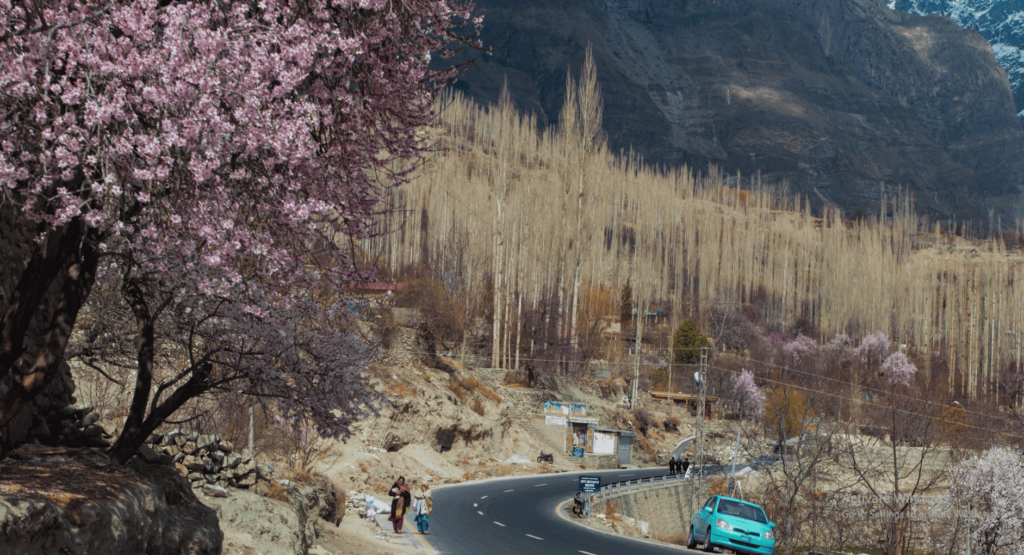
Springtime magic along the legendary Karakoram Highway in Hunza Valley.
The best time to visit Hunza is from April to October. During these months, the weather is pleasant, and the region is in full bloom, offering stunning views of the lush valleys and snow-capped mountains. Spring (April to May) brings colorful blossoms, while summer (June to August) offers warm temperatures, ideal for trekking and sightseeingTo experience these seasonal changes without missing key viewpoints, check our guided Hunza tour packages.
Safety & Travel Tips
Check weather forecasts & road conditions before departure
Expect road delays due to occasional landslides and maintenance work
Keep warm clothing, especially if traveling in early spring or autumn
Carry emergency contacts and a first-aid kit
Refuel in Gilgit, as fuel stations are limited along the way
Food Specialties
This region is rich with hearty local dishes such as Chapshuro (a meat-filled pastry), Momo (a type of dumpling), and Skardu’s specialty, mamtu — a type of dumpling filled with beef or mutton.
Accommodation Options
From cozy guesthouses to modern hotels, the Skardu to Hunza route offers a range of options to suit your comfort level.
Frequently Asked Questions (FAQs)
Q1: How long is the drive from Skardu to Hunza? About 5 hours 20 minutes of moving time for the 289 km. In practice, plan on 7 to 8 hours: fuel, a meal stop in Gilgit, and checkpost registration account for most of the difference. Allow 9 hours or more if there is roadwork or a slide being cleared.
Q2: How is the road from Skardu to Hunza? Paved the whole way. The Gilgit-Skardu Road (S-1) was rebuilt and widened (completed 2021), and the Karakoram Highway from Gilgit into Hunza is in good condition. Because the S-1 remains exposed to weather, minor delays from rockfall are usually a matter of hours rather than full route closures.
Q3: How do I get to Hunza Valley from Skardu? By road, on the S-1 to Alam Bridge and then the Karakoram Highway through Gilgit. Most travellers either drive themselves, hire a private vehicle with a driver, or travel to Gilgit first and continue to Hunza from there.
Q4: How far is Gilgit from Skardu? About 197 km — roughly 165 km on the S-1 to Alam Bridge, then 32 km on the Karakoram Highway into Gilgit. It takes around 3 hours 25 minutes of driving. Gilgit is the natural halfway point of the Skardu-to-Hunza journey and the main place to refuel.
Q5: Can you drive from Skardu to Hunza in winter? Yes, The main route stays open through winter — snow and ice on the S-1 add extra travel time rather than closing the road, and occasional short waits for clearance are normal. The Deosai route is the only track that closes in winter (it is only passable from June to September).
Q6: Do foreign travellers need a permit for this route? No. Skardu, Gilgit, Hunza, and the main Karakoram Highway connecting them are open areas. A valid passport and Pakistani visa are all you need to present at checkposts along the way. Permits only apply to specific restricted trekking zones, not to this main highway.
Q7: Which is more beautiful, Hunza or Skardu? They are distinct rather than competing — Hunza is greener with terraced orchards around Karimabad, while Skardu features high-altitude deserts, vast lakes, and stark mountain walls. Most travellers with enough time visit both. We compare their landscapes, activities, and travel logistics in detail in our Hunza vs Skardu comparison guide.
About the Author
Written by Shahid Hashmi Reviewed by local drivers Last reviewed and updated: September 10, 2026
Shahid Hashmi writes travel guides for Northern Discover, focusing on practical route information, distances, travel times, transportation and on-the-ground planning for journeys across Gilgit-Baltistan. This guide to the Skardu to Hunza distance by road explains both major driving options — the faster route via the Gilgit-Skardu Road and Karakoram Highway and the more adventurous route through Deosai Plains and Astore.
The route details have been reviewed with local drivers familiar with travel conditions in the region, helping Northern Discover present the journey from a practical road-travel perspective. Because mountain road conditions can change with weather, maintenance and seasonal access, travelers should confirm current conditions before departure.
Northern Discover aims to make travel across Gilgit-Baltistan easier to understand with useful, locally relevant destination and route information.
Travelling on into Hunza? Our Hunza tour packages start from Gilgit or Skardu.